I made a cool app, where I use the map componente of ai2. I try to capture places, where I find muchrooms. I run (drive) aroumd in the forest, where I do not have cellular connections with my phone.
Is there a way to get the cards offline?
In order to plot on a OpenStreetMap or a Google Map a WIFI or data connection is needed to see a map display ordinarily (there are exceptions).
Yes. Spicy_Topics pointed to two discussions where SteveJG explains how App Inventor can use cached map tiles for previously visited by an app using OpenStreetMaps.
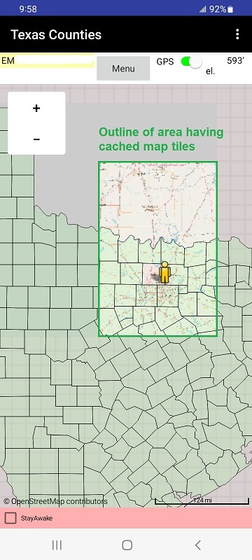
The Texas Counties app shows an outline of the area where maps cached previously are used when WIFI or data is not available as an example.
Here is a third awkward but possible way to plot on a 'map' when you do not have WIFI or data connections to the Internet.
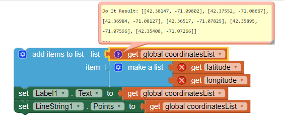
However the LocationSensor does NOT require access to the Internet to capture your present coordinates. Why? It uses the hardware radio to listen to the GPS satellite transmissions, even when WIFI or data access to the Internet is not available. Consequently your app can capture coordinates when you are finding mushrooms and save them to a text file. Later post those locations on a OpenStreetMap when you get back to town and see a map of where you have been. You also can use a Map component to create a LineString and capture a 'trac' or 'track' of your trip. Something like this could capture a LineString