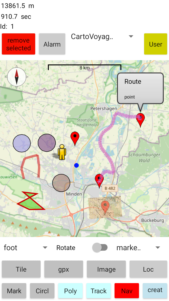
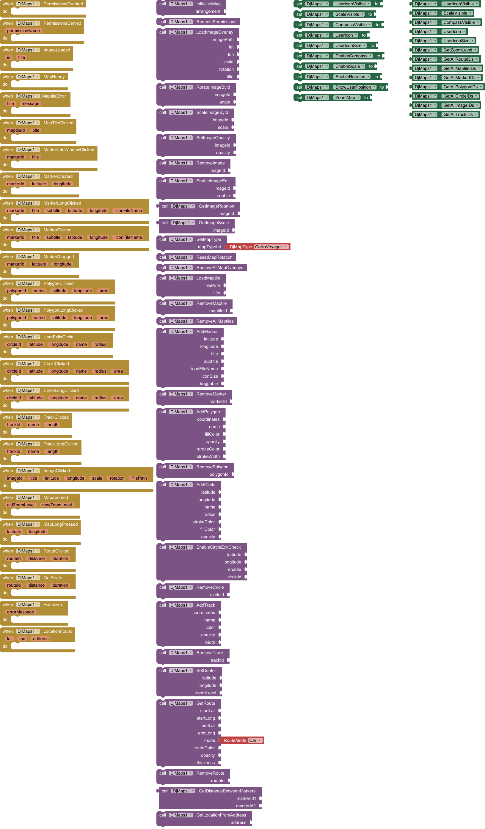
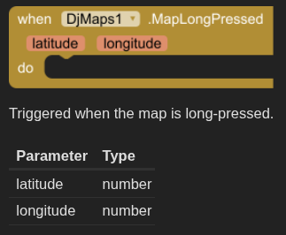
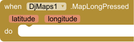
There isn't a MapClicked clicked event available in this extension The developer included 16 Event Blocks but not a MapClicked so you need to use the DjMaps.MapLongPressed
Triggered when the map is long-pressed.
Parameter
Type
latitude
number
longitude
number
Or you can use the native App Inventor Map control which has a TapAtPoint event.
TapAtPoint(latitude,longitude)
The TapAtPoint runs when the user taps at a point on the map. The tapped location will be reported in map coordinates via the latitude and longitude parameters.
The Map control is more flexible and easier to use for OpenStreetMap access than this extension in my opinion.
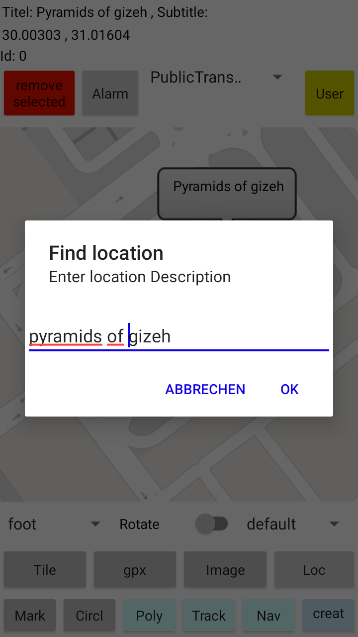
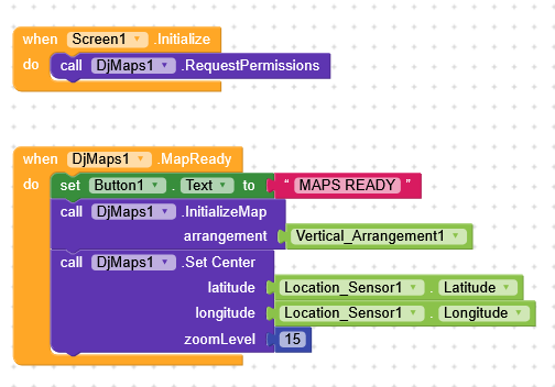
The main issue is that you didnt read the posts above where it is described how to set up the blocks
Ps: an update to fix the road map bug is ready but not released yet. Maybe in 2 weeks when i return home.
init map in screen initialize.
It doesnt make sense to init the map when map is ready, right?
Why dont you just test the provided aia and learn how to use the blocks?
 Specifications