Bonjour,
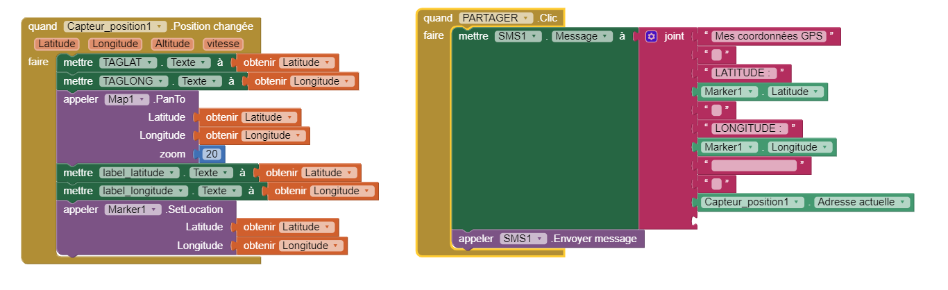
j'ai créé une application (sur MIT APP INVENTOR, galaxy S9+)qui indique dans des champs textes ma latitude et ma longitude. Puis une carte de ma position.
lorsque je clique sur partager, cela envoie mess cordonnées gps, et mon adresse par sms.
problème 1 : les coordonnées gps arrivent très vite, mais la carte et très longue à charger ( 3 à 4 minutes)
problème 1 : je ne sais pas comment envoyer la carte ou une photo de la carte par sms.
problème 3 : est-il possible de créer un bouton pour activer le gps sur mon application ?
J'essaie de joindre un imprime écran...
Merci d'avance,
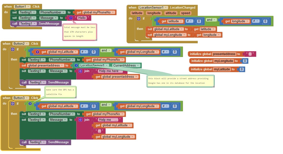
Also set the LocationSensor.TimeInterval to 30000 using Blocks in a Screen1.Initialize Block.
problem 3 --- this is button1's code
problem 2 - you cannot use this method to send an attatchment of a map or a photo. The Texting component sends sms messages, not mms (multimedia messages).
problem 1 . The gps receiver in your Android must obtain a satellite fix to know where it is located; this process frequently takes 30 to 60 seconds. Until your device achieves a satellite fix, the Android will not have the coordinates available to send as a Text.
I also have more or less the same concern, I would like to share my position in real time. When I click on the share button that the button brings me back to the different social networks installed on my phone and allow me to share this position in real time so that the other can follow me
Share your current address? Share your latitude and longitude? Share a map displaying your current position in real time?
Here are some possibilities:
use either the MIT CloudDB, FirebaseDB or GoogleSheets to share your location with others who have your app loaded and active.
send an email or a text message (sms) as shown in the May 26 post.
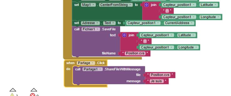
use the Sharing component * Sharing . This component should be able to Share text with no issues with various social media apps (if you share your current street address or share your latitude and longitude). See the documentation. If you create a map, it might be able to send the map as an image (I don't know if it is possible to share an image this way; you can try sharing an png map. You can use the code mentioned here to create a map; How to show your location in a Map component How to put my location on a map or use an intent (ActivityStarter solution). Here is Taifun's advice using Sharing Sharing photos and gifs to the social media
There may be other ways. What have you tried Benjamin?
I have created an interface that displays my postion, the problem is that I have to save this map and share it so that every time I move my position is shared and the other can see my movements
Here are alternative ways to share a location in real time. They require each person you want to share the location with has your app on their device so they can view your location:
One of those tutorials might do what you want to do Benjamin.
You can also share your location by posting your location coordinates to a GoogleSheet and provide the link of the Google sheet to your friends. This is a more complex way of sharing the data.
Recently Salman has created an extension that allows one to send images to What's App WhatsAppTools Extension [Free & Open Source] - #17 by Salman_Dev . You may want to try that even though you said you don't want to share the png. Use the SendImage Block might work.
"share the display format map link to track the other" ... what map link? and how do you want to share? Several methods to allow others to either see a map showing your current location have already been mentioned. You can also share your 'current address' or geocoordinates (latitude and longitude) using either a CloudDB, FirebaseDB or GoogleSpreadsheet.
If you use Google's Map api to create the map, you can use the api to send someone the map's url. Static Map . To use this, you must have a Google Map API key and post the url to a Google spreadsheet. Users could use this URL to post a map. A severe problem is that you would expose your api code to everyone and you shouldn't do that.
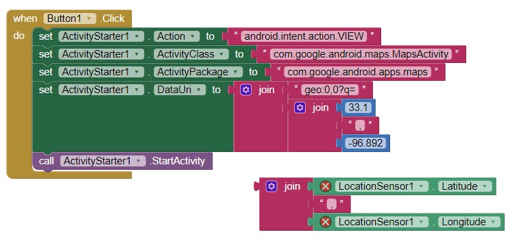
or you can use the ActivityStarter using an intent. Something like this if you know your latitude and longitude
I have recently made a Buddy Tracking app using Location Sensor and Google Sheets as a repository for storing and sharing location info data. All people using the app are u ploading their location info as Lat and Long Values to a Google Sheet, and all have access to the LAST reported position of all users. You can CHOOSE which one you want to see on the map. So your own location an well as the selected persons latest position gets plotted, and refreshed based on a Clock Timer. and thanks to assistance by TIMAI2 for some Google App Script function and triggers.
I guess one just has to clearly define the desired output first and then work backwards to see the best possible was to achieve it