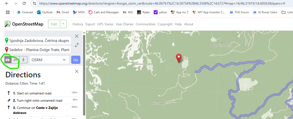
i am building IOS version of my android hiking app. Very important part of app is road navigation to the starting point of particular hike. For android app I use preinstalled Google Maps app triggered by activity starter and web component.
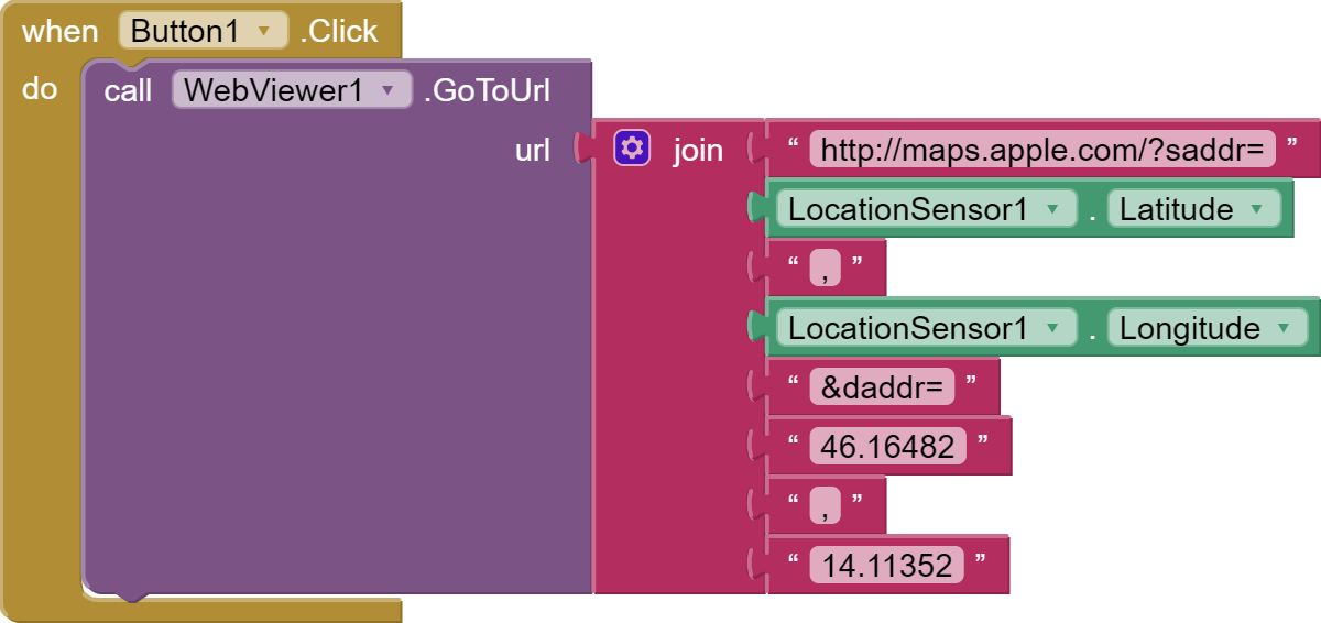
I tried similar with IOS version of my app, but as far as i know activity starter/web component solution is not possible for IOS. Therefore I tried following with IOS Google Maps app:
Hi Steve,
i tried map/marker/navigation according to your use case: HOW TO: Use the Navigate control.
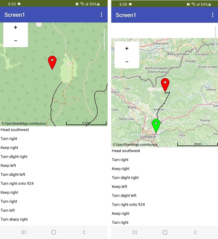
For better testing/understanding purpose i deleted some blocks, pls check image. In case of not so distant starting point of particular hike navigation works fine.
Then I tried distant starting point high in the mountains. In that case road route is displayed, i guess, correctly but map almost completly freeze. Maybe too much waypoint inspite distance is similar in both cases, about 55 km.
Pls check image. EndMarker inside updateDestination procedure contains close location that works ok, if you change them with distante location (two horizontal latitude/longitude blocks on right side of updateDestination procedure) map freeze.
OpenStreetMap tiles are often not as detailed as other map platforms. The OSM tiles are created/updated by volunteers. The tiles frequently do not have outback trails etc. on them. Tile details available are generally a function of enthusiasts in their location or country updating the maps. If detailed information is not on on the tiles, one cannot navigate to that location but can place a Marker there. OpenRouteService is also provided by volunteers. If your input coordinates for start or destination are too far from a documented road or trail; you may get an error indication. Tile zoom may only get as high as 15 for some maps or as many as into the 20's.
i tried map/marker/navigation according to your use case: HOW TO: Use the Navigate control. did you try on both Android AND ios ? Same results on both?
Pls note that I dont need off-road/outback navigation. For that purpose i have my own trails made by Garmin device. I need only road navigation to the starting point of particular hikes. There are many remote places as starting points to our mountains but all are accessible by car. Regarding remote road places high in the moutains I guess that is a problem - "If detailed information is not on on the tiles, one cannot navigate to that location..."
Google Maps have no problem to navigate to these places, not sure about Apple Maps.
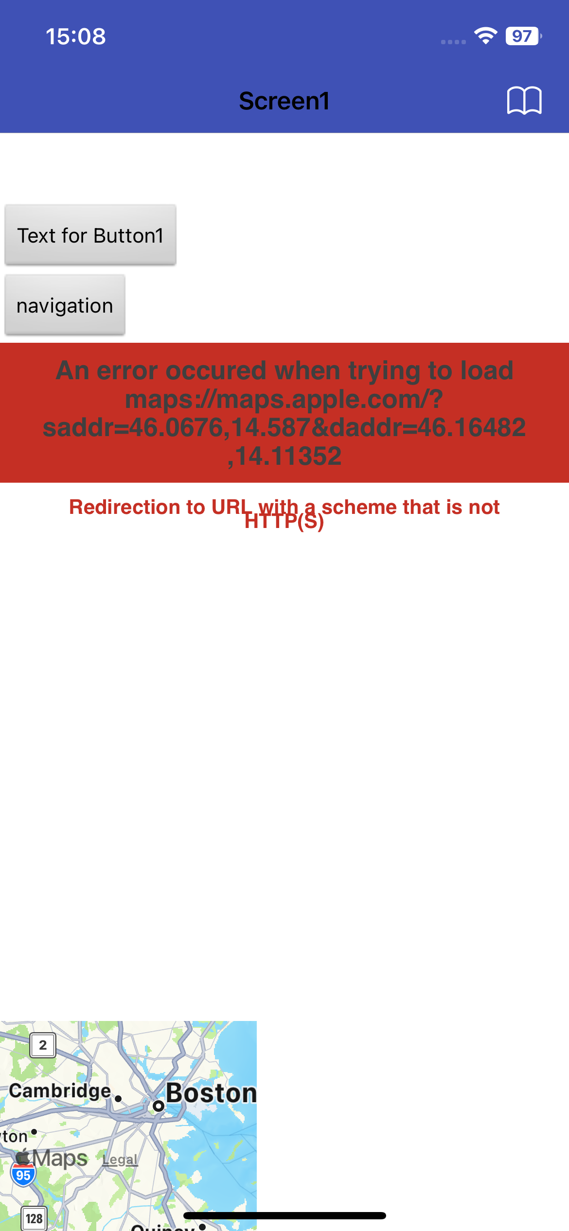
I just tried on IOS but app crashes.
May i ask to move to my initial question. Is there any way to prevent error that occur when using WebViewer to trigger Apple Maps? If that is not possible
how to check if Google Maps are already installed on iphone?
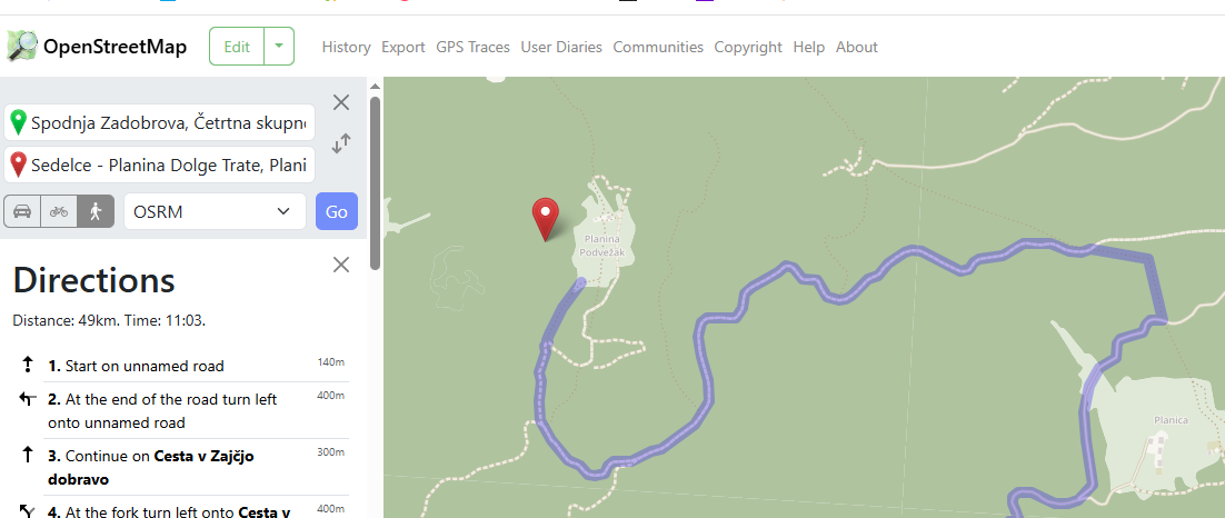
The left image shows your destination (red marker) and the route. The right image shows the long journey from your start to the red marker.
OSM has difficulty finding the exact location you provide. That can be fixed by moving the start to a location on a road. When that is fixed, it will provide a turn by turn route. That is another problem, ORS provides every turn for each switch-back you will encounter and in the mountains there are a lot of switch-backs. Each switch back is a Point; there are so many points the app uses a huge amount of memory.
Complicating the problem it appears this works for Android but crashes ios (severe memory problem ??? or something else ???) Sorry, I can not test this.
Google Maps
App Inventor does not have a Google Maps control. You might try this extension
I don't know if it would work for you as I have not tested it.
Probably not possible.
No idea. perhaps someone who uses ios will comment.
You might be able to use the GM extension to use it in your app.
a possible alternative is to use a Bing map which might have more tile resolution [FREE] BingMap extension
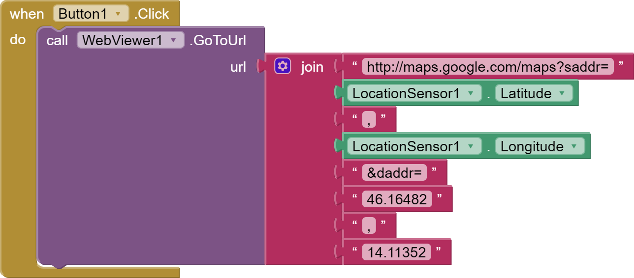
Pls note that best solution so far is to stay with Google Maps using WebViewer component.
WebVierwer opens web Google Maps where users locations is displayed, therefore it can be used for road navigation.
Of course Google notifies user to move to Google Maps app (with single button press) due to better experience which is ok if Google Maps app is installed. If user is not willing to install Google Maps app on Iphone he/she can further use web Google Map aplication for road navigation.