Thank you
@sinolumbathelma , I have been experimenting. I have an example using two ListView components I would like to publish as a tutorial for the community showing how intents can also be used to locate buildings.
If I have your permission to use your Zimbabwe building csv in the tutorial I will post the tutorial in a few days and a copy here for you to test. I need to know the Zimbabwe part of the tutorial works.
Thank you.
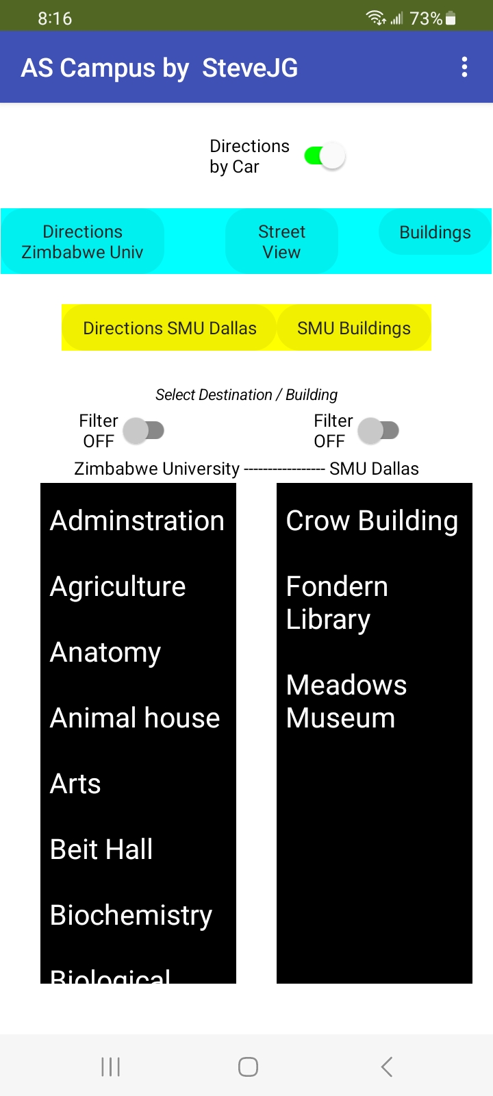
You can use the buildings Csv
1 Like
Thank you.
Please try TwoLV_CampusExperiment.aia (12.3 KB) and let me know if if works for you.
-- Steve
Good day
I tried out the TwoLV_CampusExperiment and its working properly and l actually enjoyed working on it instead of the other one that we have
Thus l want to try and leave the buildings for University of Zimbabwe only
Thank you for testing. I am glad you like the alternative way to provide directions using ActivityStarter intents.
You can try this
GM_CampusDIrections.aia (10.1 KB) which uses two File controls and two ListViews. The second csv is a dummy place holder.
Simplify the code further using a single File component to load two csv data sets. I used two File controls as a demonstration proof of concept in the above example. Code showing how it would work
loadTwoCSVFiles.aia (11.7 KB) . You can keep GM CampusDirections as it is or adapt the code. Both ways to add additional csv files work.
Good luck.
Thank l will definitely try them out and modify the codes. I am truly learning a lot
May you kindly explain the differences between these applications and a background l want to have a better interpretation of the blocks
Is this what you are looking for?
Latest version of the navigation app for a campus include
- Intents Intents do Google Maps para Android | Maps URLs | Google for Developers
- Using the Activity Starter
- Using the Location Sensor
Earlier versions showed navigation and location methods using these tools (in addition to some of the tools mentioned above:
yes thank you
Good Day
The navigation application is based on the open street map, how do l integrate walking paths that are not visible on the open street map and activate them to be visible and link them to walking block if user wants to use foot to move around the campus
Several ways to add foot paths to your OSM map.
A FeatureCollection
- Create a FeatureCollection of the paths using the LineString tool on geojson.io . (sorry, this might not be possible for the Zimbabwe U campus; you may have to use a different tool)
- Draw the foot paths where you need them on geojson.io tool

and save the result.
- Load the paths FeatureCollection into your Map component.
These tutorials show how to use the tool at geojson.io and how to load the FeatureCollection file.
1 How to make a Map Overlay-Part I
2 How to make a Custom Map Overlay Part II .. Show the user on the Map and a Custom Map Overlay
LineStrings
- Create a set of LineStrings using the LineString component. You might use a List of coordinates of the foot path for each LineString.
- Use code similar to this
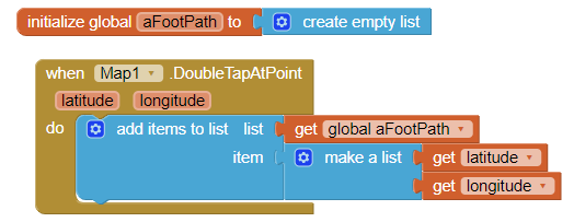
to create the List of coordinates for a single foot path;
- save the List;
- later add it to a LineString showing the path.
- Use a new LineString for each path you want to add to your Project.
You can, if you have the patience, manipulate the shape of the LineString on the Designer. Difficult but possible
Get the foot paths you need added to OpenStreetMap.
- Join the team of OSM volunteers who are allowed to add features to the official OSM tiles. The OSM web page explains how to add features to their map tiles.
Sorry, you can't do that unless you join the OSM mapping volunteers.
I already have the paths as a shapefile so l will convert them to geojson and add the through feature collection
I tried joining the OSM mapping volunteer am still waiting for their response
Good Day
The featurecollection component falls under maps so is it possible for me too use it in this aia
(https://community.appinventor.mit.edu/uploads/short-url/wT8vsKWE2ozaPeCeEiaqB84kZHW.aia) so that l can integrate the digitized walking paths
No, it is impossible to integrate the digitized walking paths . The link you provided uses a link to Google Navigate to provide directions and a map. Developers can not modify Google Maps using a Map Feature Collection and use it this way to 'update' the features of the map.
Import a FeatureCollection using one of the examples for a campus map that uses the MIT Map component and if the FeatureCollection is well formed should possibly allow you to integrate the digitized walking paths on the MIT OpenStreetMap map.
Thank you
Good Day
am facing challenges with using the feature collection , the application is saying the is a bug after l upload the geojson file.


Please post the map.geojson file you load here. You have to change the geojson suffix to txt to be able to post it in the community.
This geojson has two paths (each a LineString created in the FeatureCollection) and loads fine.
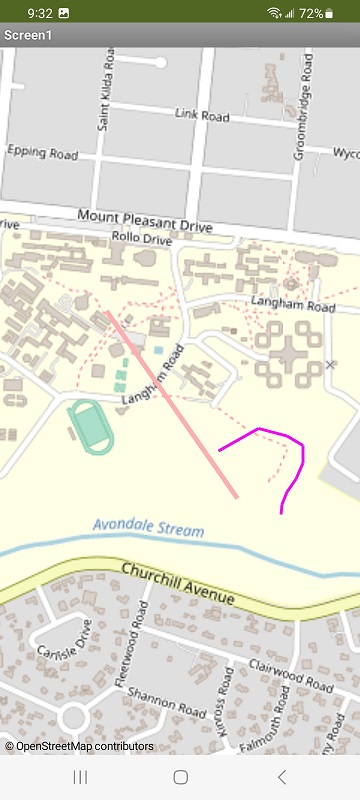
zlinestring.txt (1.4 KB)
was created like this using the geojson io web tool.

Your problem could be a too complex FeatureCollection or the FC has features App Inventor does not recognize etc.
Try this aia 
add_featurecollection_to_Map.aia (2.4 KB)
The add feature aia is working
As l was trying to convert the geojson file to txt it's reporting message that the file is corrupt so l will try again to draw the paths

This topic was automatically closed 7 days after the last reply. New replies are no longer allowed.