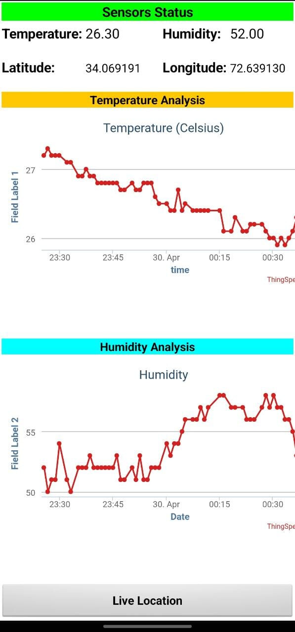
I am sending a latitude and longitude to thingspeak server with the help of NEO-6M GPS Module connected with arduino. I have received all the parameters which are shown in the image showing sensors status/data.
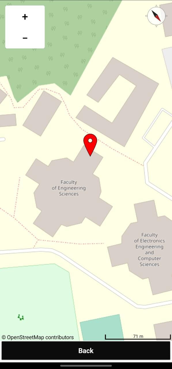
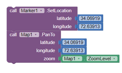
Now I want to display the location on a map with the help of marker using those values of latitude and longitude, just like shown in the figure on the map using mit platform.
I will be thankful for helping me out.