Any extension for using Raster Maps (Geotiff tiles)?
If not, is any stalwart trying to make it ??
Any extension for using Raster Maps (Geotiff tiles)?
If not, is any stalwart trying to make it ??
I want to try that, but I don't understand, what is the usefulness of the extension
It gives you the facility of using custom maps for offline use. At times certain organisations have their own maps (paper maps) which are scanned as tiff images and then georeferenced for use on GIS platforms (Desktop as well as mobile). They are very useful in far flung ares which are devoid of GPRS connectivity, where online maps do not work.
There is a open source app code on github, but NOT exactly as per requirement.
I am also interested in this. I found this thread from several years ago referencing using a flat map as a canvas, but I haven't been able to figure out how to implement it yet.
https://groups.google.com/g/mitappinventortest/c/9BqtQdWkWRU?pli=1
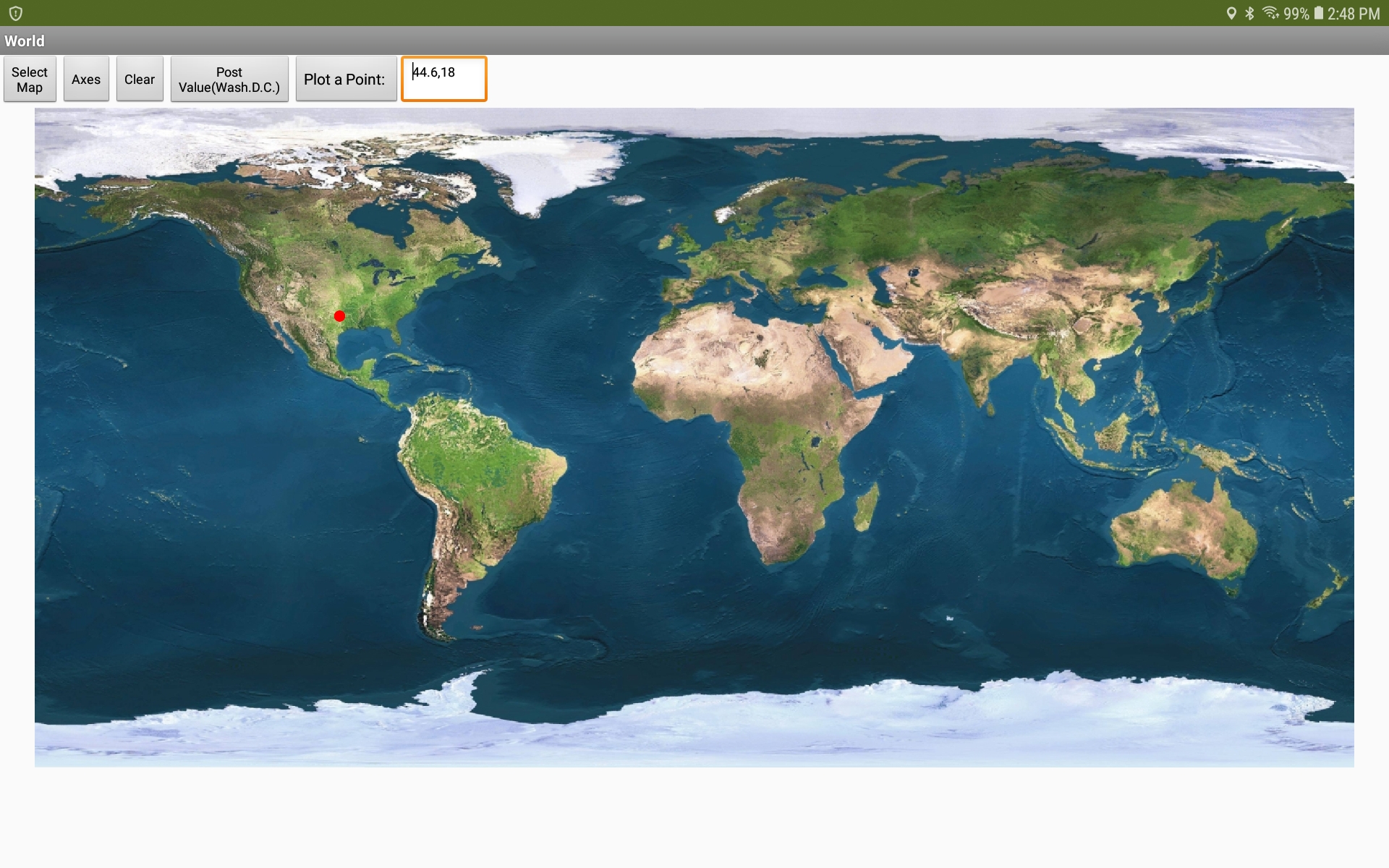
Welcome Tom. @Tom_Jarvela The link is a example showing how one can make a Flat Map using Blocks and an image of a map and a Canvas and use a LocationSensor to post coordinates on that 'map'. The discussion might might be the explanation you are seeking. It shows how to use a flat map as a canvas to draw on or post geocoordinates.
The example does not show how to make a raster map. It is a discussion showing a way to use an image (map) inside a Canvas. The developer can post geocoordinates onto that 'map' provided he/she knows the latitude, longitude of alternate corners represented on the map.
You can use it for very large areas
. This example shows a location posted near Dallas, Texas on a Mercator like NASA image of the World and the LocationSensor. When you use a Canvas for large area maps, plotting precision is dramatically reduced.Regards,
Steve
Couple of issues as far as doing it on MIT APP inventor
I am working on it. will have a test aia ready in a couple of days Will revert on this.
If you use a 15 min x 15 min map on a 300px x 300 px canvas, for every change of 1 min in geo coords, your dot has to move 20 px.Now the calculation has to be in X and Y axis. So u need to go down to Seconds instead of calculating in Minutes
1 Minute movement means 20 Pixels
60 Seconds = 20 pixels
3 seconds = 1 pixel
Location sensor default values are in Degree Decimal. U will need to convert to Degree Minute Seconds, then capture the change in seconds
A +ve change in Lat will move the dot UP
A -ve change in Lat will move the dot DOWN
A +ve change in Long will move the dot RIGHT
A -ve change in long will move the dot LEFT
(This is for locations in the 2nd Quadrant)
Like wise you need to know which quadrant you are located in to define the move Up / Down or Left / Right)
Use a software called gmd (Google Map Downloader) to download spatial raster data in various available formats. it is avilable for download on www.allallsoft.com)
@Anup_Ludra,
Did you ever get a sample app going and have an example aia?