Hi everyone,
I want to share this extension to access the free OpenWeatherMap APIs: Geocoding, Current Weather, 5-day/3-hour Forecast, and Air Pollution.
To use the extension You need a free APIKey from openweathermap.org. Sign up, then generate your key from your account page. The free plan already gives access to all the functions implemented in this extension, with a limit of 60 calls per minute and 1,000,000 calls per month. Full plan details: Detailed price.
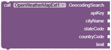
Looks up the coordinates of a city by name.
Parameters
apiKey(text) — your OpenWeatherMap API keycityName(text) — the city to search forstateCode(text) — US state code, or leave empty ("")countryCode(text) — 2-letter country code (e.g. "IT"), or leave empty ("")limit(number) — max number of results to return
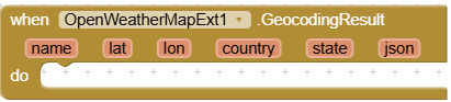
Fired when the search succeeds. Returns 5 parallel lists — same index across all 5 lists = same place:
name(list of text) — place namelat(list of numbers) — latitudelon(list of numbers) — longitudecountry(list of text) — country codestate(list of text) — state, if applicable (mostly for US)json(text) — the full raw response from the server, in case you need something not listed above
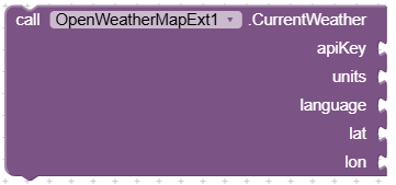
Gets the current weather for a location.
Parameters
apiKey(text) — your OpenWeatherMap API keyunits(text) —standard(Kelvin),metric(Celsius), orimperial(Fahrenheit)language(text) — language code for the description (e.g.en,it)lat(number) — latitudelon(number) — longitude
You can find a list of language supported here: Current weather data

Fired when the request succeeds:
temp(number) — current temperaturehumidity(number) — humidity percentageweatherMain(text) — short weather group (e.g. "Rain", "Clear", "Clouds")description(text) — longer weather description (e.g. "light rain")icon(text) — icon code you can use to build the icon URL (see "Weather icons" below)json(text) — the full raw response, includes fields not listed above such as feels_like, pressure, wind, clouds, sunrise/sunset
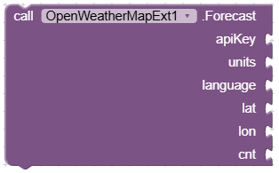
Gets the 3-hour step forecast for the next 5 days.
Parameters
apiKey(text) — your OpenWeatherMap API keyunits(text) —standard,metric, orimperiallanguage(text) — language code for the descriptionlat(number) — latitudelon(number) — longitudecnt(number) — how many 3-hour time steps to return (max 40 = 5 days); use 0 to get all of them

Fired when the request succeeds. Returns 7 parallel lists — same index across all 7 lists = same time step:
dtTxt(list of text) — date and time of that step (e.g. "2026-07-18 09:00:00")temp(list of numbers) — temperature at that stephumidity(list of numbers) — humidity percentage at that stepweatherMain(list of text) — short weather group for that stepdescription(list of text) — longer weather description for that stepicon(list of text) — icon code for that stepjson(list of text) — the full raw entry for that step, includes fields not listed above such as wind, pop (chance of rain), rain amount, gust
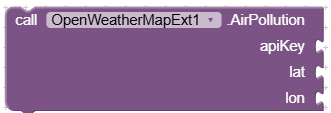
Gets current air pollution data for a location.
Parameters
apiKey(text) — your OpenWeatherMap API keylat(number) — latitudelon(number) — longitude

Fired when the request succeeds:
aqi(number) — Air Quality Index on OpenWeatherMap's own 1–5 scale: 1=Good, 2=Fair, 3=Moderate, 4=Poor, 5=Very Poorco(number) — carbon monoxide concentration (μg/m³)no(number) — nitrogen monoxide concentrationno2(number) — nitrogen dioxide concentrationo3(number) — ozone concentrationso2(number) — sulphur dioxide concentrationpm2_5(number) — fine particulate matter concentrationpm10(number) — coarse particulate matter concentrationnh3(number) — ammonia concentrationjson(text) — the full raw response
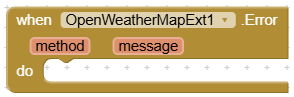
A single event shared by all four functions above — fired whenever a call fails (network problem, invalid API key, invalid parameters, server error, etc).
method(text) — which function triggered the error: "GeocodingSearch", "CurrentWeather", "Forecast", or "AirPollution"message(text) — the error description
The icon code you get from CurrentWeather and Forecast (e.g. "10d", "04n") can be turned into an image URL like this:
https://openweathermap.org/img/wn/{icon}@2x.png
Example: https://openweathermap.org/img/wn/10d@2x.png
Full list of icon codes and conditions: Weather Conditions
Extension:
OpenWeatherMapExt.aix (32.0 KB)
Sample Project:
[OpenWeatherMapSample.aia|attachment]
OpenWeatherMapSample.aia (73.5 KB)

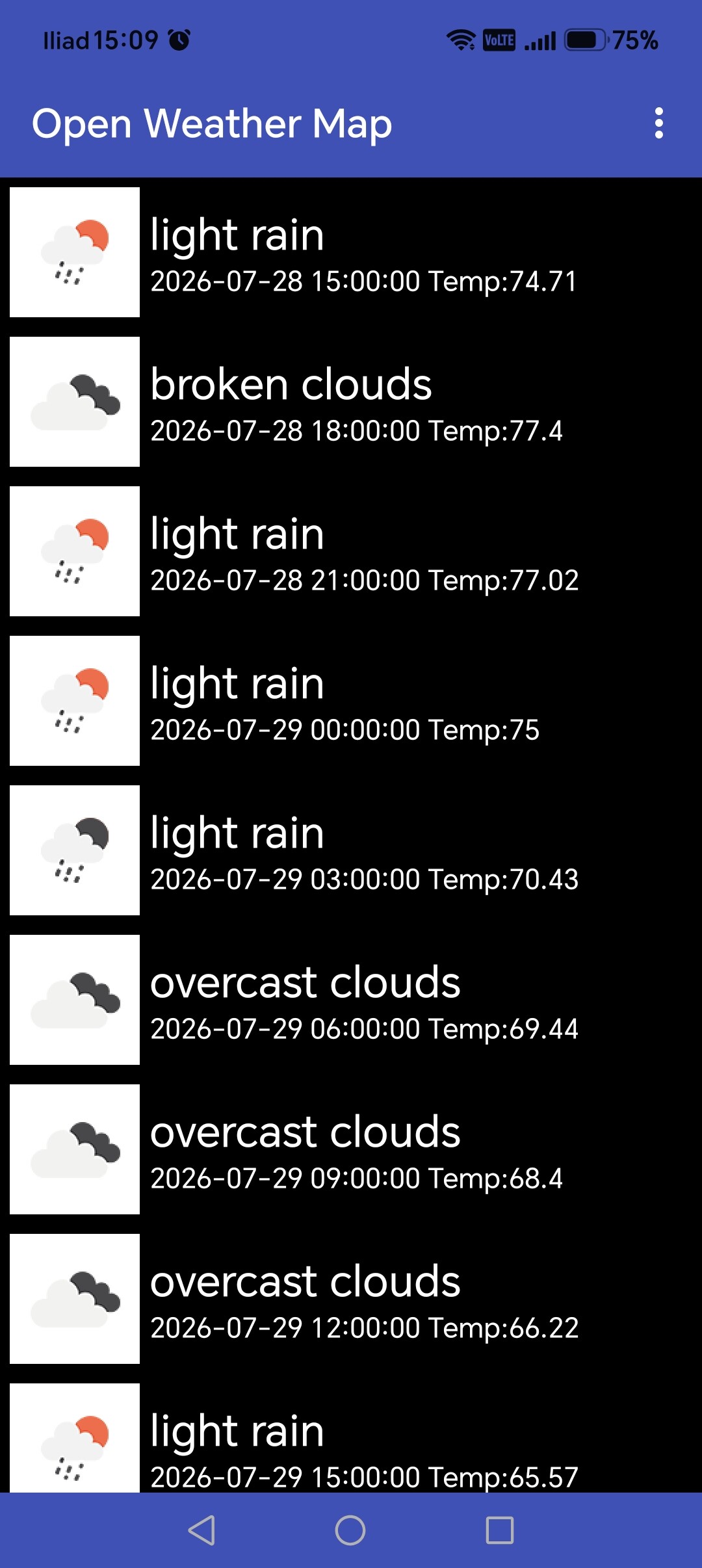
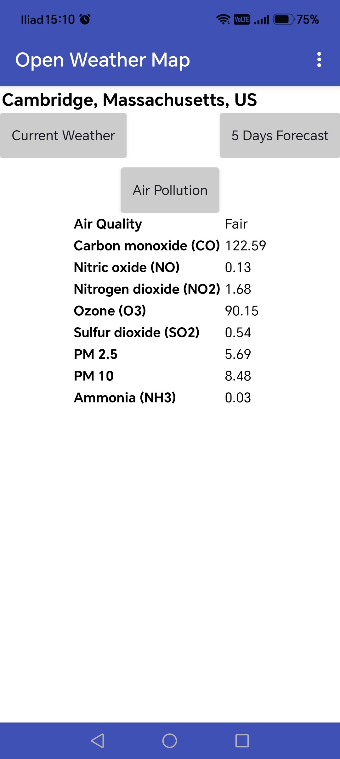
In this sample project, instead of making an HTTP request every time to download the icon image, I preferred to load them all into the project from the start.
I hope You find useful
Best regards
Marco Perrone

 ).
).