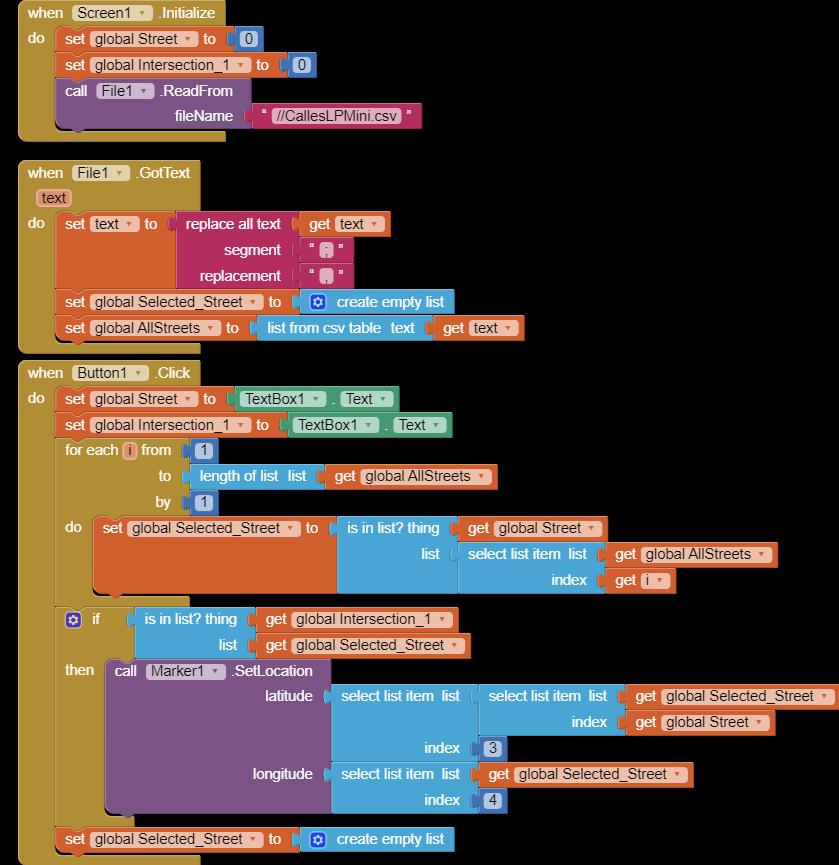
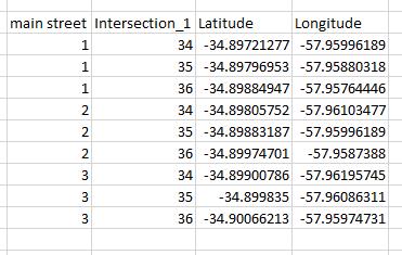
Hi all. I did an app to establish the streets that intersect the main street and the address number selected by the user. This works fine. Now I would like to put a marker on a map indicating the main street between the two intersections found. For that I built a CSV file with Excel entering in the first column the main street, in the second the first intersection and in the following the latitude and longitude (I was based on the NationalParks_2.aia for doing that). In the worksheet for now I only included 3 possible intersections for 3 possible main streets. My intention was to load the main database (AllStreets) and search for the main street selected by the user, to generate a secondary database (Selected_Street) containing only that data (hoping to receive only 3 lines of data). From there, my intention was to search within that database for inersection_1 and from there, to establish the latitude and longitude of the marker. As expected, it did not work for me, so I go to someone who can give me a hand and get me out of ignorance. Thanks.