Hello,
In the fall I was able to have kids make a tour guide app which showed a map behind "place settings."
Today as kids were trying to make the app, Mit App Inventor only showed grid lines. Might there have been an update of some kind recently that disallows the maps from showing?
Thanks
Jason Smith
Illinois
Welcome Jason.
OK, but we do not have a copy of your Project. Is the Project a copy of code from a tutorial? If so, which one?
Are you using the MIT Map component to display your map? This behavior could be due to the OpenStreetMap server being temporarily overloaded with requests. At the moment, the server is working OK. Do you have more students in your class now than last Fall? This could be an issue of your school 'overloading' it serve due to students 'competing' for bandwidth.
Could you kindly post a Screen capture of what you see and provide a more detailed description of the map.
Are you using the latest Companion 2.62 ?
The latest version of App Inventor (nb188) was made November 11th, 2021.
1 Like
Thanks for your response as to what I need to check. I have a similar amount of students this year as last and am using "MIT App Inventor CTCT Curriculum". As it turns out several of the tablets DO require an update to the companion.
If you're doing this in a school environment, it is possible that the school is blocking connections to the OpenStreetMap tile servers.
1 Like
Thanks, there are several things to check, and I didnt think of all of them, so it was good I posted here. Since 1 tablet was showing the map and didnt show the "update" message, it rules out the site blockage.
Which specific tutorial Jason? Could you provide a Link? I do not have access to those resources. 
A possibility, if the tour Guide tutorial uses this Block (marked with a red x ), the Block is the potential problem.

Often when using that Block a Map will refuse to render correctly. I find, instead, that if you replace that Block with the two Blocks marked with a green check mark, a user can often eliminate the problem of incomplete rendering of the map. Try substituting. 
I am using the MIT App Inventor CTCT Curriculum which can be found on the MIT App Inventor site.
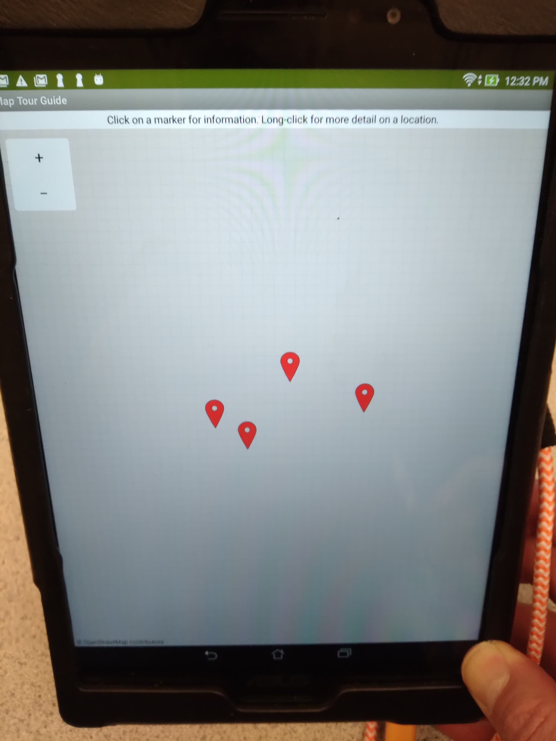
I have attached a screen shot of the place holders on a grid
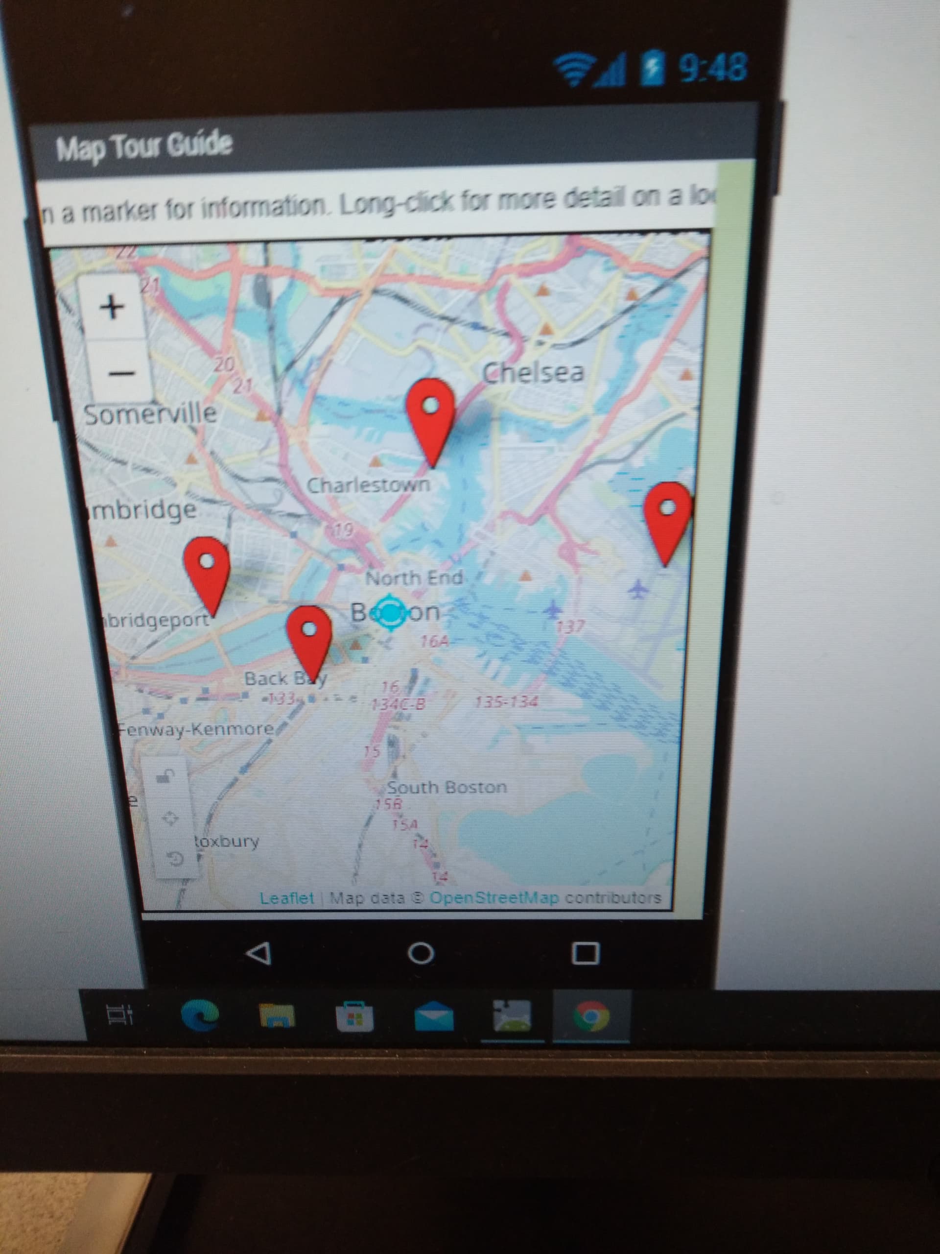
I have attached a screen shot of what it should look like with placeholders on "top" of a map.
I have included the template.
I have included the "solution" or Boston Example
I updated to the latest 2.62 version
It is not working at school, it works from home....
BostonTourGuide_complete.aia (187.7 KB)
TourGuide_template1.aia (3.3 KB)
Your IT department probably needs to white list openstreetmap . A guess is the IT department added additional security since your last teaching season. You might wish to share School IT/Network Admins: Information specific to school networks with them.
Thanks for the example aia; it works fine using my Samsung A10 tablet over a home network.
1 Like
Thanks again for you help and suggestions. I will share the doc with the IT department.
Here is a link to the OSM web page (the MIT Map component links to their api) illinois | OpenStreetMap
You can test this and see whether your school allows linking or is blocked.
Good luck.
1 Like