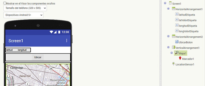
Hi. I am programming the following app: when I click a button the longitude and latitude appear and a map with a position marker. I have a problem with the map: it does not appear ( the area appears blue colored or a grid
If the area appears blue you probably see that because your LocationSensor has not yet determined a location change or satellite fix. The default location prior to a location changed event is 0,0 . A latitude and longitude located off the west coast of Africa which is located in the South Atlantic Ocean. The map shows blue for water areas.
A grid shows sometimes when one uses the Mapa1.DesplazaA control and the app cannot find the correct OpenStreetMap tile to display.
You have other issues including trying to set the list of Providers they way you did. I would eliminate the LocationSensorNombreDeProveedor block from Screen1.Inicializar block.
What can I do so that the map appears instead of the grid?
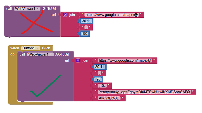
The top Block sometimes fails to find the correct tile and the Map displays a grid.
I use the CenterFromString and ZoomLevel Blocks instead of the single block. The map ALWAYS goes to the map image. ![]() provided the LocationSensor changed event works.
provided the LocationSensor changed event works.


