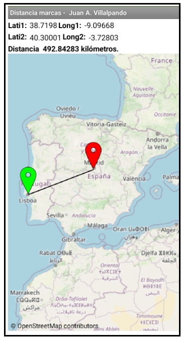
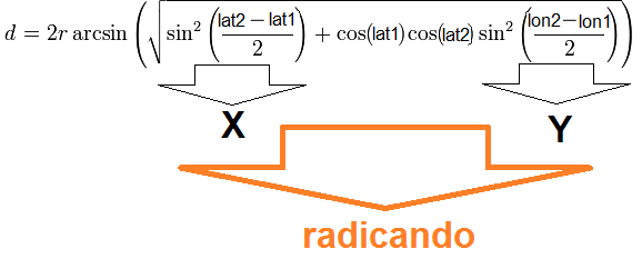
- Calculation of the distance between two geographical points by the Haversine method.
- In Designer - Properties: Marker1 and Marker2: Draggable
- Static map using EnablePan: false
- When stopping the drag any of the two marks calculates the distance between them.
- When you tap on the map a mark is placed at that point and the distance is calculated.
p_49ci_haversine_marcas.aia (4.1 KB)