Hi sir, I wanna adopt this to use it to my project gps guided robot using esp32. can you help me sir? thank you
only a little bit Zandro. I do not use esp32 or Arduino so I can not help with the bluetooth communication between the robot and your Android .
This might help
then read the rest of the thread where people with bluetooth to esp32 offer suggestions
If you have a specific question; I may be able to help. You are sending the linestring coordinates from your espn32 to your Android?
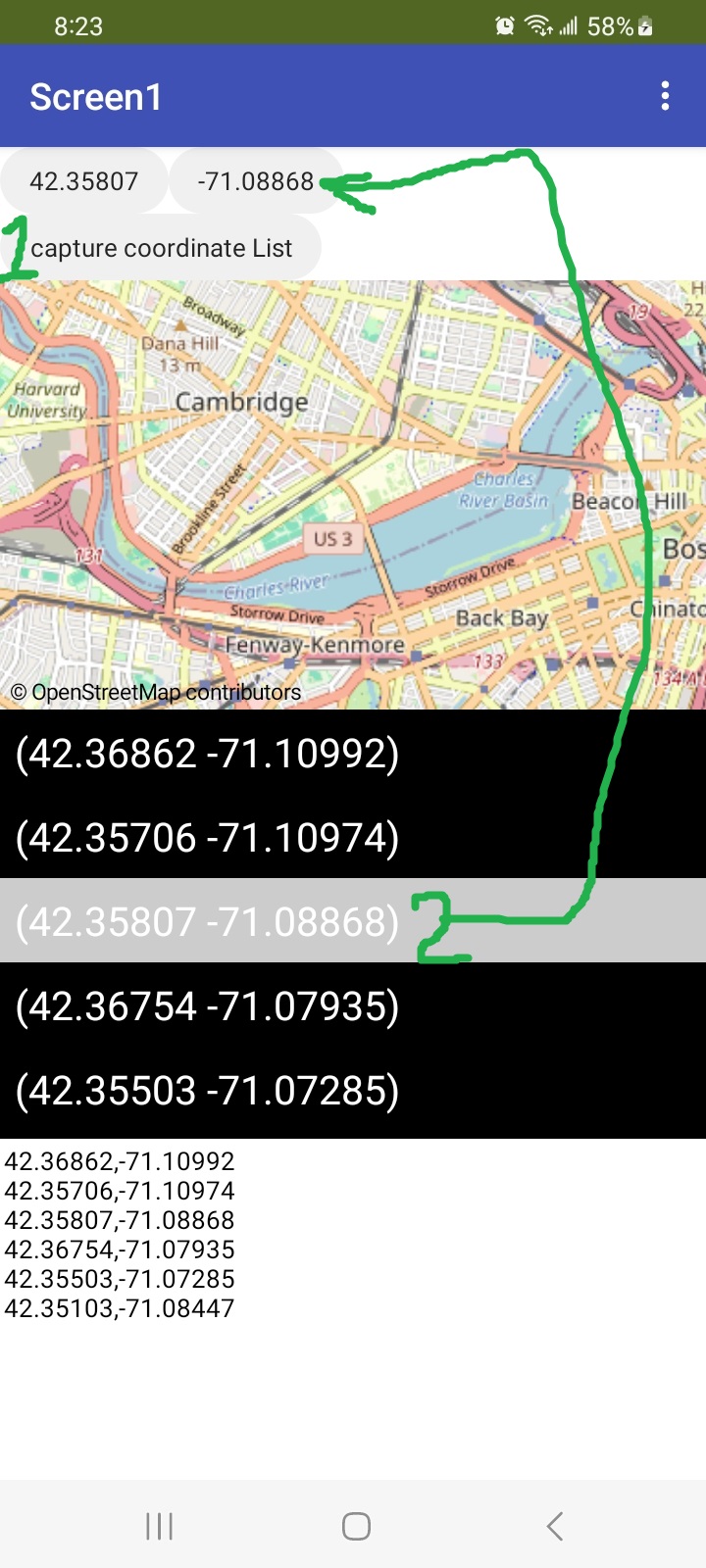
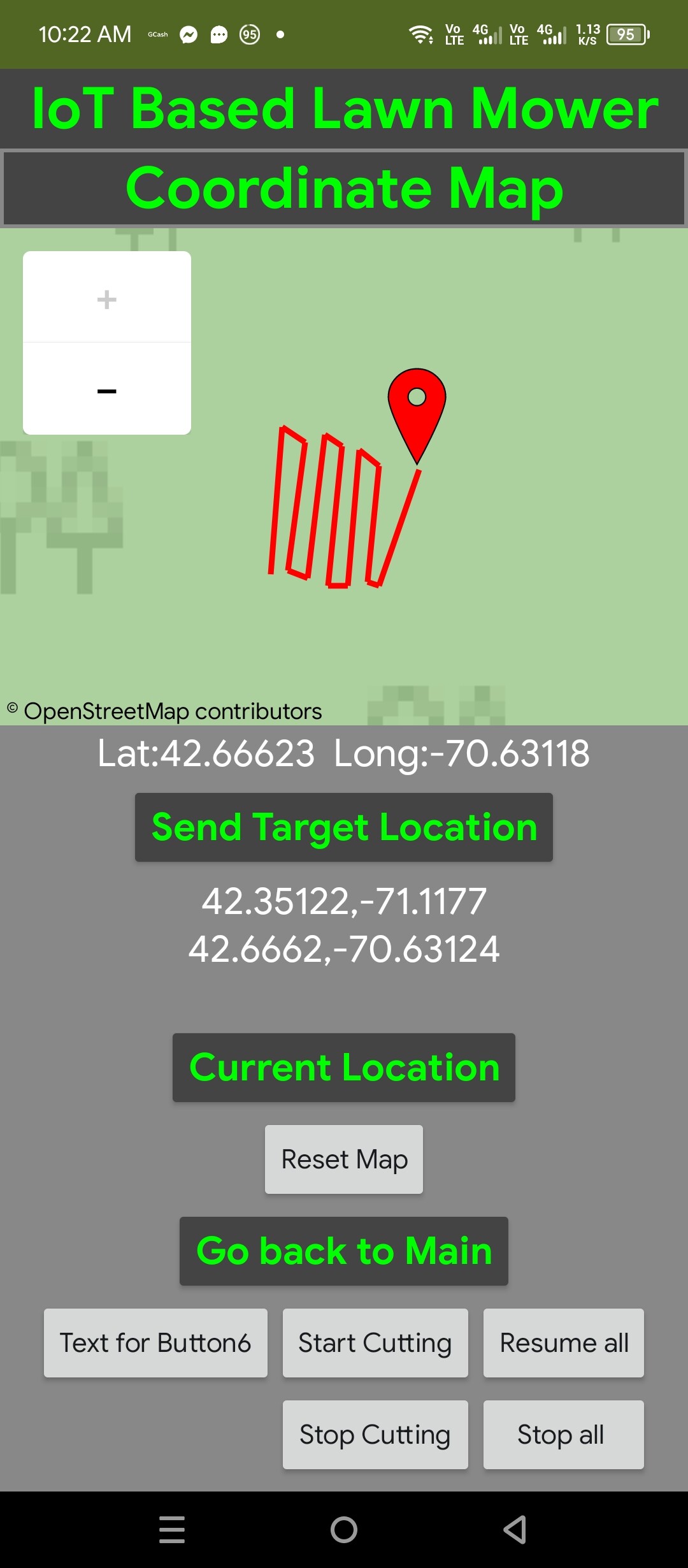
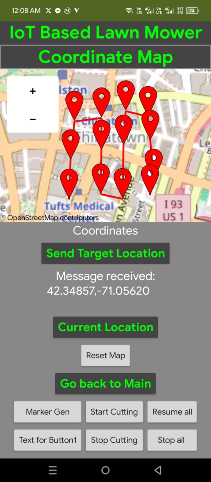
this is my current progess sir
I'm going to send the coordinates [0,0]/n that I draw on the map, to my esp32. I just need to know how to extract the coordinates format sir. to send Just like what you did here, but send coordinates to esp32

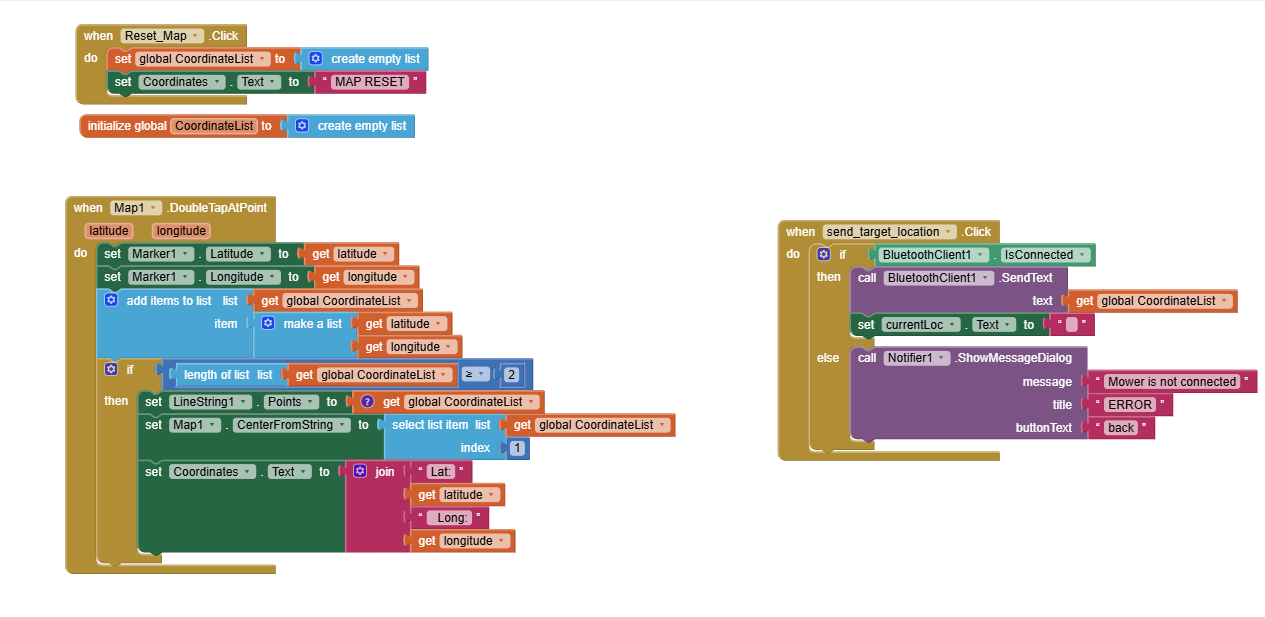
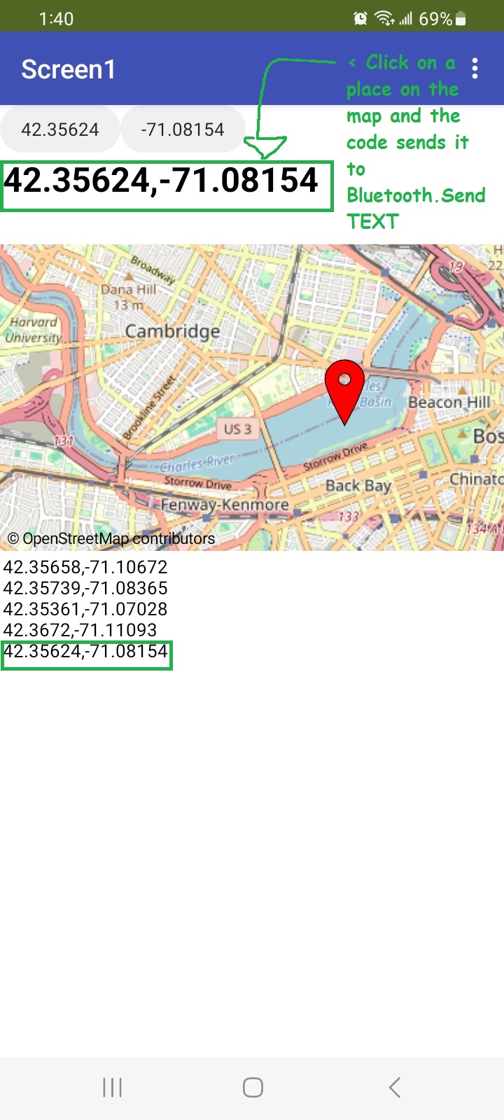
This should extract coordinates
- select coordinates from map tap
- then use #1 capture coordinate List to transfer them to the Listview.
- in ListView select #2 item you want to transfer to your robot. The examples transfers the coordinates (lat and lon) to the Buttons.
Hi sir I tried your blocks, and I'm really confused. I don't know how to get the coordinates that I draw on my map to send to via BL
Is this correct way of sending the coordinates to my esp32 sir?
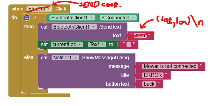
The idea is like this, i plot(map) the coordinates after ploting I will send target loc. to my esp32 in a [0,0] format sir. As many coordinates it can
can you check my app sir? the only problem Im facing is just getting the coordinates that I draw and sending the coordinates via BL
GPS_Guided_Mower.aia (8.2 KB)
I do not know. What is supposed to happen when you send that code?
I do not think it is possible for you to control your mower this way.
-
you want the mower to follow a path you create using a LineString (what many would a track or trac) automatically.
You can create the track and plot it. Your program so far does that. . What is not clear is the code required to use your esp32 . I certainly do not jbiq what is supposed to happen when you send BluetoothClient.SendText (lat,lon)\n Does that mean the mower moves to that gps location. It doesn't matter, I do not know how to help you with this. I don't have an esp32 with a gps module or a mower that can control a motor to advance, stop, turn etc. the mower.
 -
realistically the gps in your esp32 can on its BEST day is resolve 2 meters (it will probably at best resolve to 10 meters). That is what your can do too.
-
have you read Using the Location Sensor
-
what someone tried might help. It is supposed to use App Inventor to control it.
Yes just like that
Yes, sir, just like that. I have already completed the hardware, and the code for my esp32 is also ready. my only problem is sending the coordinates that I draw on the map to esp32 via bluetooth, just like sending a text to it. For example, sending sc/n text will halt the cutting motor.
BluetoothClient.SendText sc\n
What i want to do is extract the coordinates that i draw and send them as lat,long/n text. Even how many lat and long the esp32 will receive I already code it that way.
I just need to know where will I get the coordinates that I draw and how to send the coordinates via bluetooth in a text form lat,long/n.
is it
BluetoothClient.SendText get global Coordinatelist(for example)? Idk, this is just what I want to know sir
perhaps this

It moves the Marker where you touch the map and sends lat,lon using Bluetooth.SendText as indicated and to a Label.
and will do the same every time you touch the map.
That's all it does. That's all I can help you with. I won/t waste my time using a LineString to send all its coordinates. I believe that is NOT USEFUL. Good luck.
You need a GPS with more precision like RTK. You will never be able to control lawnmower with phone gps
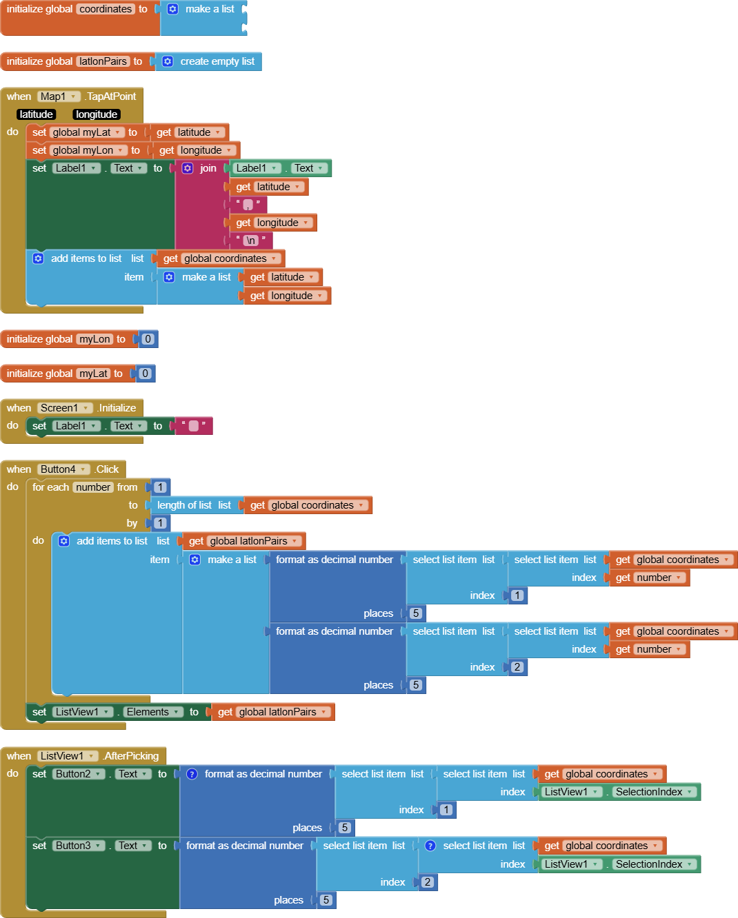
Hello sir sending coordinate is working, thank you. But how to send multiple coordinates? (not gonna use linestring to send all its coordinate ) I will be using markers instead just like this,
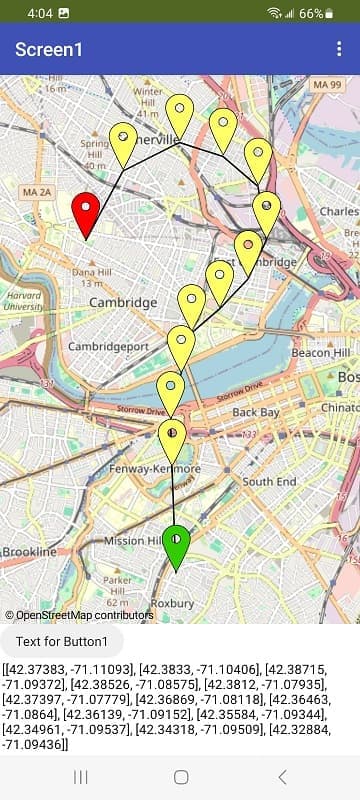
which I found here From list of coordinates to marker + linestring on map But viseversa, marker+ linestring on map to coordinatelist. Your help would be very much appreciated for my school project. ![]() thank you sir
thank you sir
Very good.
- if you do that, use a Runtime Marker or have a lot of Designtime markers on your Android map.
You already have a List of the coordinates. Consider using a Clock to automatically send the coordinates (which are in a List) at a set interval. ![]() This way you won't need all the coordinates captured in a LineString (only the most important coordinates at where the lawn mower is supposed to change direction).
This way you won't need all the coordinates captured in a LineString (only the most important coordinates at where the lawn mower is supposed to change direction).
Just try something Zandro. You have to do a trial and error exercise because only you have the hardware to test the feasibility of doing it and know exactly how the app should behave.
Hello sir, it's me again ![]() hope u're not tired helping me
hope u're not tired helping me ![]()
just wondering, how will I get all of these coordinates of these markers from (call map1.CreateMarker) in order <lat1,long1><lat2,long2>... so on. I can only send one coordinate which I gues it's from (map1.doubletapapoint), I want to send multiple lat,long in one send if possible ![]()
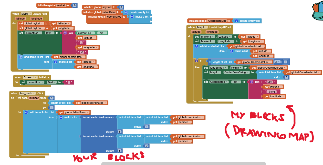
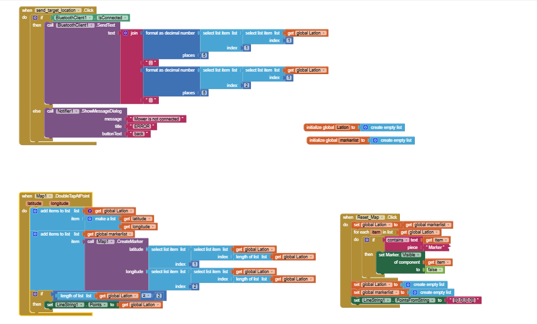
by the way here's my current blocks.
thank you again :>
Normal gps isn't accurate. you will end up mowing the highway
1 Like
You are storing a list of your coordinates in global variable LatLon
To send several coordinates convert the list into a table in csv format using the list to csv table block and sent that
Don't forget to remove the items from the list you already sent...
Learn to work with lists and how to debug your blocks
Use the companion app and Do it to debug your blocks, see also tip 4 here App Inventor: How to Learn | Pura Vida Apps
see also Live Development, Testing, and Debugging Tools
Taifun
Trying to push the limits! Snippets, Tutorials and Extensions from Pura Vida Apps by ![]() Taifun.
Taifun.