Good morning to the forum, I apologize in advance for my bad English, I use the translator.
I need help from the forum for an application of mine of which I attach the aia file.
The application detects my coordinates through a LocationSensor and when there are at least two positions detected, using the "Stop" button I disable the LocationSensor with the "Trach" button I display my trace on the map.
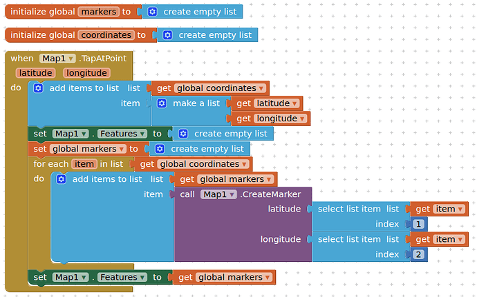
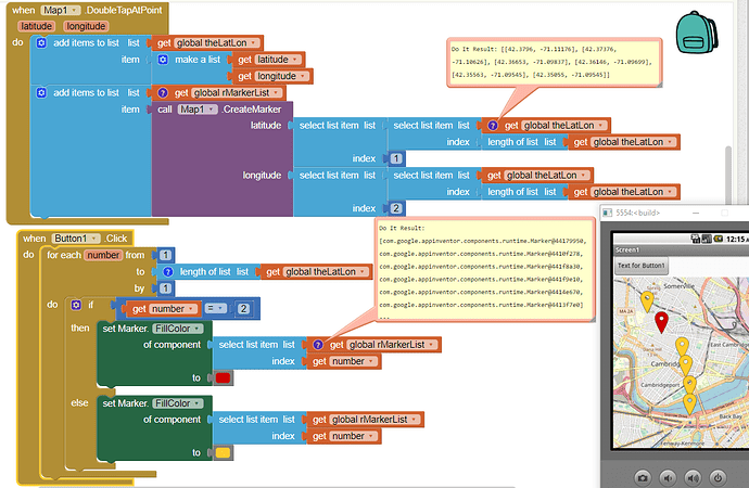
I would like, if possible, that the map also shows some Markers, one for each Latitude and Longitude detected in the Variables "Coordinates",
I have tried various solutions but always with a negative outcome.
I ask the forum for help with blocks to solve my problem but also to understand how to proceed for any other applications,
With the hope of having explained myself well, I thank the forum in advance for the valid help that I have always received for other problems.
Kind regards.
MyTrach.aia (17.2 KB)

