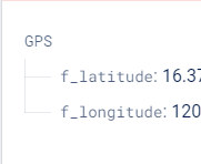
GPS coordinates are stored in my Firebase RTDB. I just want to display the latitude and longitude and display it on a map with a marker. Im kinda new to MIT app inventor can anyone help me with this one?

Hello,
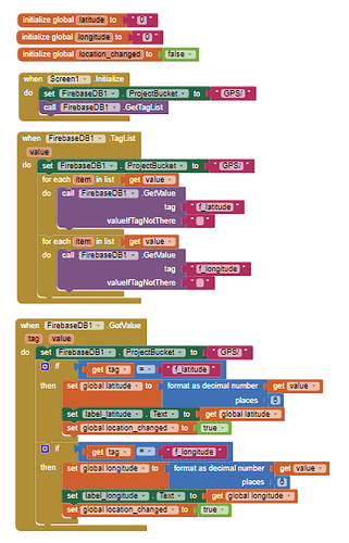
you can use the firebase component, when you can use the GetValue block,
or use the Web component to get data from firebase:
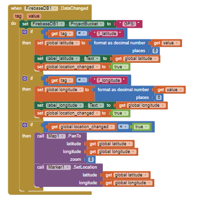
Once you have followed Ramon's advice to capture the latitude and longitude you need code to place the coordinate data on a map. You might use this code''Retrieving GPS data from Firebase DB - #6 by SteveJG
or possibly if you also want to show your current location:
which uses the Map component and setting the ShowUser property ![]()

I actually got this aia file from youtube but I can't make it work. I am using an esp32 and a gps module to collect gps data. the data collected is successfully stored in firebase rtdb but I cant seem to display those data on a map in MIT app inventor. I tried the show user property and it works thanks it's a nice feature. Can you help me with this one?
