from Gemini:
GPX (GPS Exchange Format) and KML (Keyhole Markup Language) are both file formats used for geographic data:
- GPX: Primarily used for storing waypoints, tracks, and routes recorded by GPS devices. It's common for sharing hiking trails, cycling routes, or geocaching locations. It focuses on the raw GPS data.
- KML: Used for displaying geographic data in applications like Google Earth. It can store points, lines, and polygons, along with richer content like descriptions, images, and 3D models. KML is more about visualizing geographic information on a map.
With this extension you can read or create GPX and KML tracks with elevation support.
- Handles list of lists input (latitude, longitude, elevation) for creation.
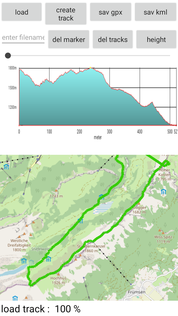
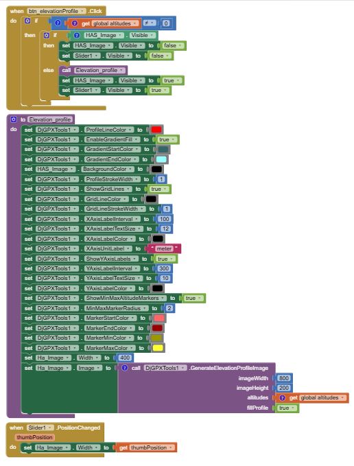
- Feature to create an elevation profile image (png) with many style functions,
Demo Video:
some blocks:
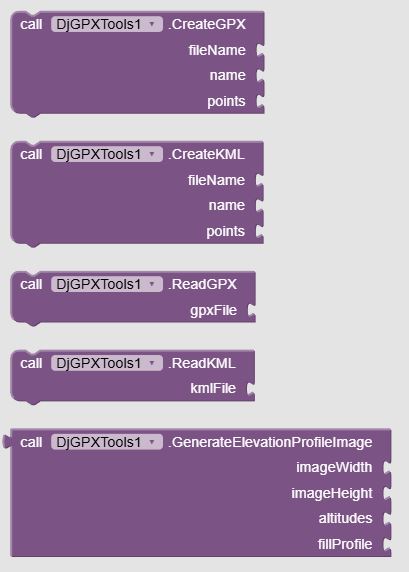

Example Blocks: create elevation profile:
Demo Aia Description:
This aia contains 2 other extensions from me, DjMaps and DjFilepicker, also available in this community. I am using it because it wouldnt make much sense if I create extensions that I am not using myself ;).
- I am also using the API from open-meteo.com (<- credits go to them!) to get the elevations from the created markers.
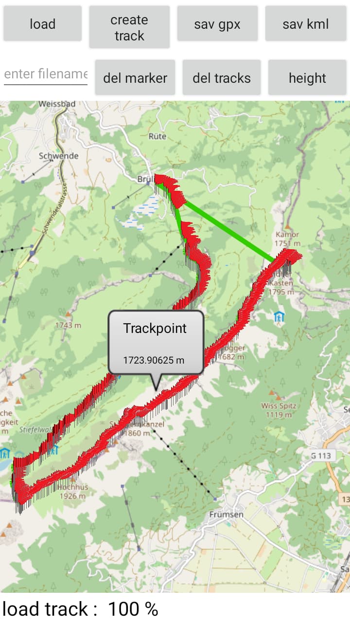
- This extension also works on GoogleMaps.
Functions: - add marker including elevation, delete all markers
- create a track, delete all tracks
- save as gpx or kml file
- open and read gpx or kml files
- create and view elevation profile with scale slider
DjGPXTool.aia (362.2 KB)
com.django.djgpxtools.aix (36.4 KB)
.