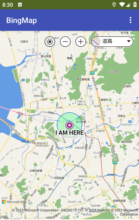
BingMap extension, for those who can not access google map service (like me), or those want to try other options.
See HERE for how to get a KEY.
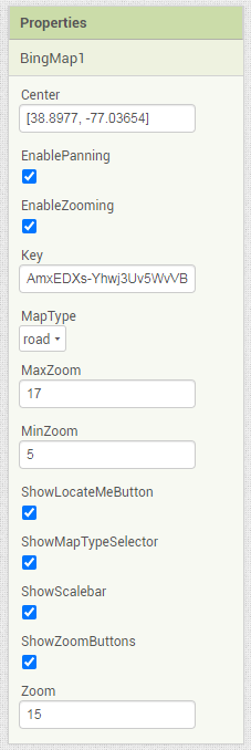
Property names are self-explained.
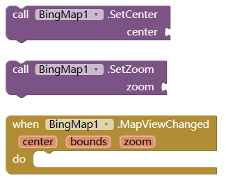
which will fire MapViewChanged event.
property
type
meaning
center
List
center of map, [lat, lng]
bounds
List
[north,west, south,east]
zoom
Number
zoom level, 1-19
property
type
meaning
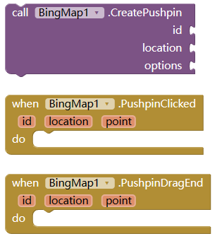
id
String
unique id for this pushpin
location
List
coordinate to show the pushpin, [lat,lng]
point
List
location in pixel, [x,y]
options
Dictionary
custom property, can be any of below
--title
String
main text
--subTitle
String
sub text
--text
String
text showing on the pin
--color
String
color of the pin, like red, or #00ff0000
--draggable
Boolean
if the pin draggable, default to false
--icon
String
can be like pin1.png, or base64 string
property
type
meaning
options
Dictionary
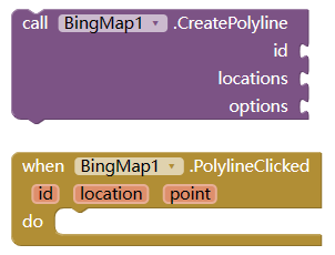
custom property for polylin
--strokeColor
String
color like red, or #00ffff00
--strokeThickness
Number
thickness of the line
--strokeDashArray
List
A List representing the stroke/gap sequence to use to draw the polyline. For example, [1, 4, 2, 1] would draw the polyline with a dash, four spaces, two dashes, one space, and then repeated.
property
type
meaning
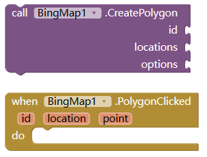
locations
List
list of location
options
Dictionary
to customilize the polygon
--fillColor
String
as explained above
--strokeColor
String
as explained above
--strokeThickness
Number
as explained above
-strokeDashArray
List
as explained above
property
type
meaning
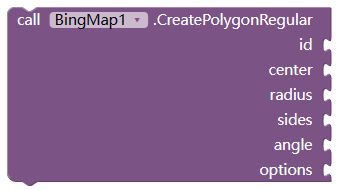
center
List
coordinate of the center
radius
Number
length from center to the sides
sides
Number
how many sides of the polygon
angel
Number
degree to rotate the polygon
options
Dictionay
as descripted above
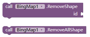
Delete shape (pushpin, polylin, polygon).
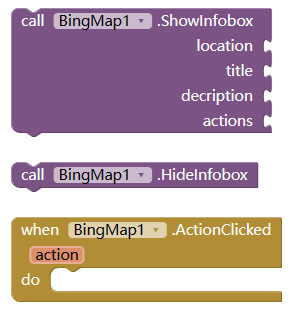
Show or hide a Infobox on map
property
type
meaning
location
List
coordinate to show the infobox
title
String
title of the box
description
String
content of the box
actions
List
buttons text which is clickable, and will fire ActionClicked event
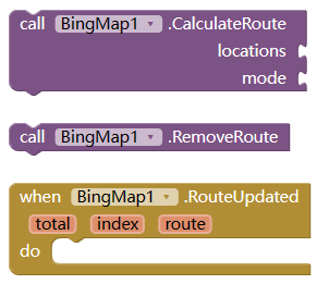
Calculate a route and show on the map. and if success, this will fire routeUpdate event.
property
type
meaning
locations
List
locations on the route, the first as starting point, the last as destination, others (if any) as midway point
mode
String
type of the route, one of "driving", "transit", "truck", or "walking"
total
Number
how many route totally got
index
Number
which route now selected
route
String
route detail, jsonarray format. User need to parse this with Dictionay
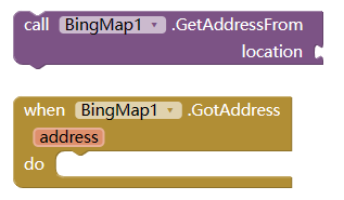
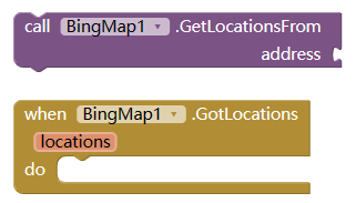
Change location [lat,lng] to address
Change address to locations, since there are maybe more than one locations with same address name.
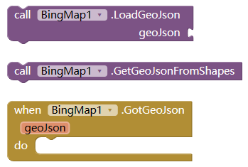
operation about geoJson String.
For more information, please refer to HERE )
take me to the download site
13 Likes
Hi center map doesn't work for me
How do you use the blocks?
Hi KevinKun.
I want to ask you a DETAIL of this extension or if you know about this.
I have searched in generally and i didn't find any solution for this."a contours maps" app, not google or microsoft, provide a way to make it from what i search it.
The contours lines are lines of same ALTITUDE and the utility is for Geography-Geology and Military, maybe there are other uses but this are all i know for sure.
Thanks.
SteveJG
August 21, 2023, 1:52pm
6
2 posts were merged into an existing topic: Contour Maps with App Inventor
Set center block , make a list , lat and lon
sorry no such method in this extension.
And also no such method in the api of Bingmap, as far as i know.
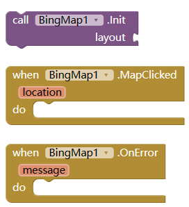
Hello good evening, ¿Can you publish any .aia example or blocks image?. I don't know how to use the conector LAYOUT. I don'y know what layout i need to use. Thank you.
layout is an arrangement, vertical arrangement or horizontal arrangement both ok.
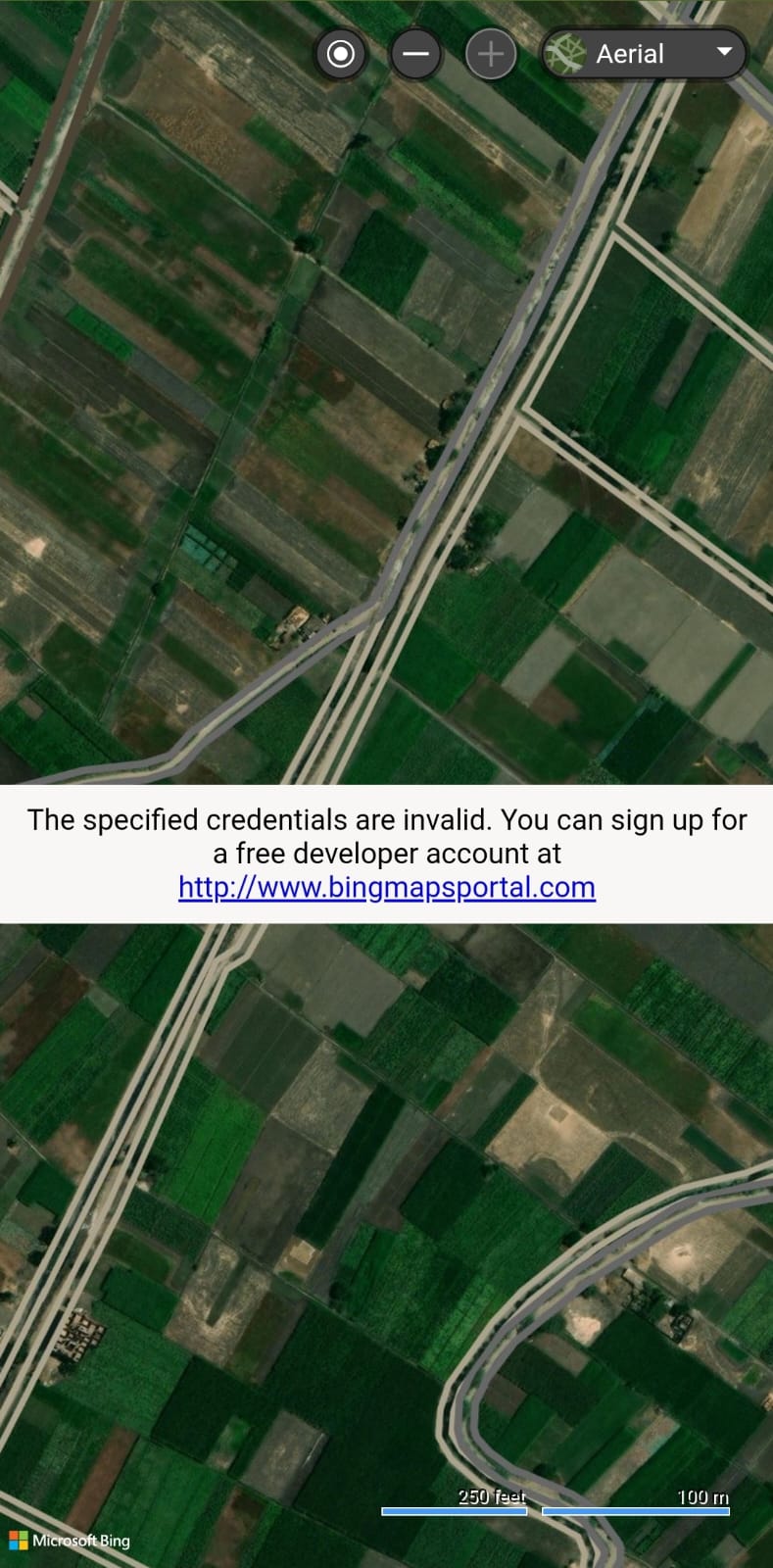
Extension give me this error
How can I solve
read first post for how to get a key.
1 Like
Is there an aia file through which I can learn how to use extension blocks?
creating points and polygons and polylines by clicking
for polyline or poligon, you need a list of locations.
My 1st trial to draw Polyline from Pushpin locations list ( It didn't work )
My 2nd trial to draw Polygon from Pushpin points list ( It succeeded, but it requires several steps to draw the polygon not in one step by click )
Is there a direct, quick block to calculate the area of a polygon ?
so how do you know the locations of the polygon?
as for the area of polygon, i need to check if there is a native function in Bing map.
All I want to do something like this in video
on map
Overlay Button to draw points
When click on any shape
The app show its properties (area + perimeter or length )
I can do only ( overlay Button to draw Points )
What about Drawing Polygons and Polylines buttons directly by click like app in the attached Video
you can drag the pushpin to change the corner of the polygon.
If you want additional function in this extennsion to calculate the area of the polygon, and you are willing to sponsor this function, you can pm me.
1 Like