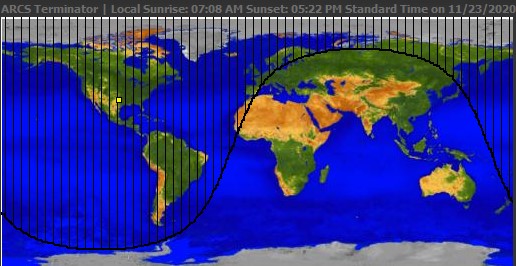
Hi, I wanted to ask that is there any way to make a daylight line in maps like the image given below-

And also showing that black area!!
Thanks!!
Hi, I wanted to ask that is there any way to make a daylight line in maps like the image given below-
Thanks!!
Its possible to make a display of the Terminator with a Canvas and a Mercator like World image.
I expect it is possible to do something similar with the MIT Map using either the LineString or Polygon and/or a Feature Collection.
What have you tried? This https://www.aa.quae.nl/en/antwoorden/zonpositie.html#v526 might get you started.
Thank you.....It worked
This topic was automatically closed 7 days after the last reply. New replies are no longer allowed.