Hello MIT App Inventor Community,
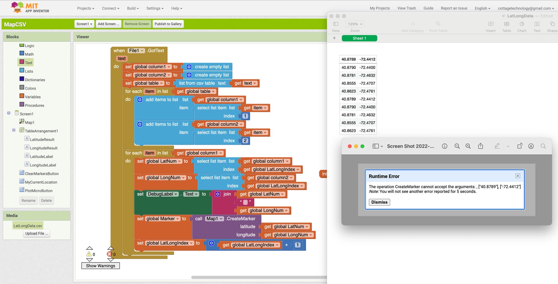
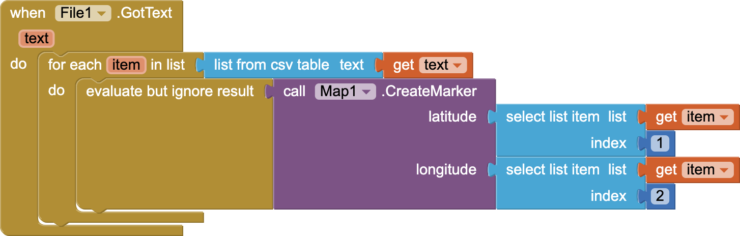
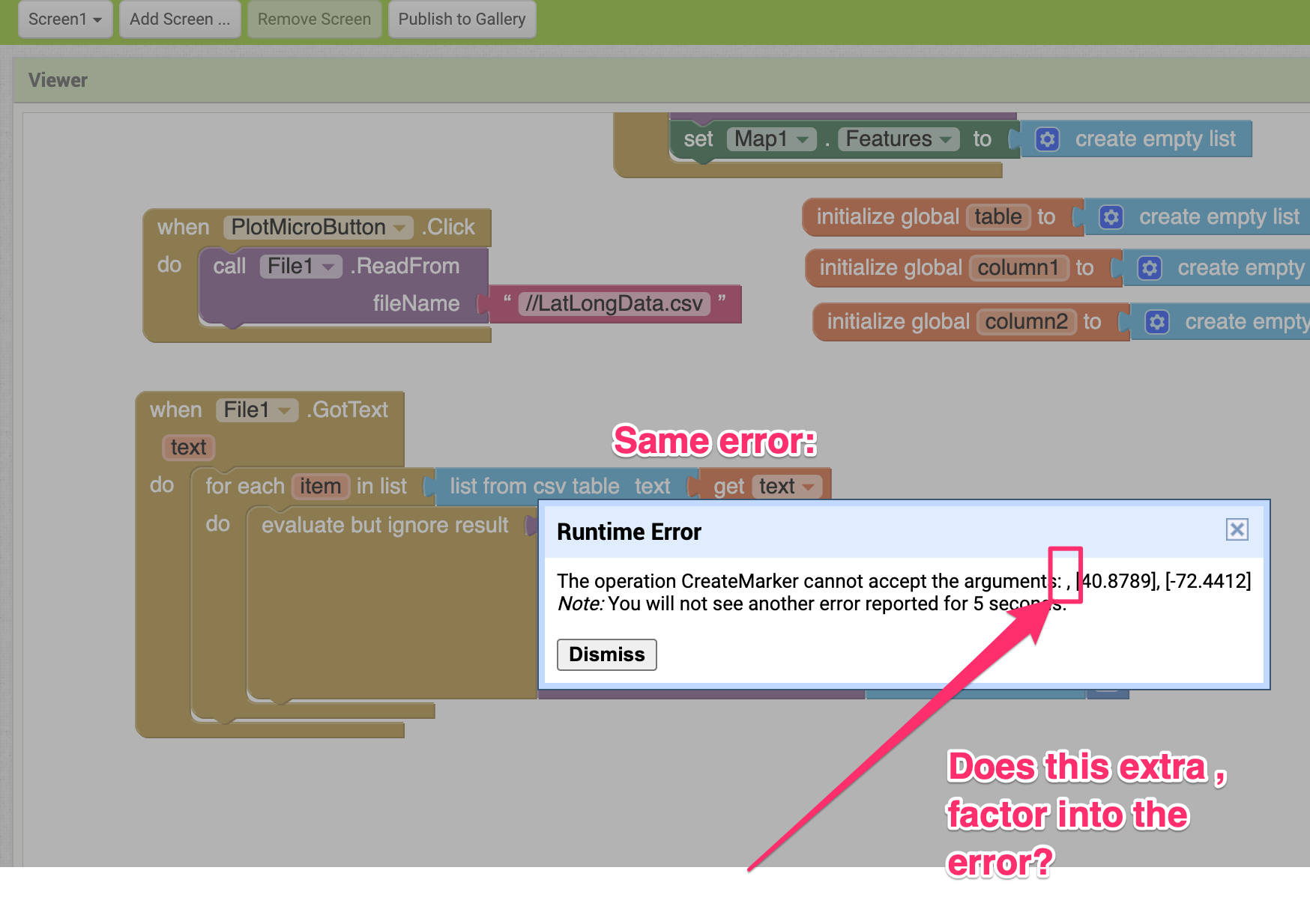
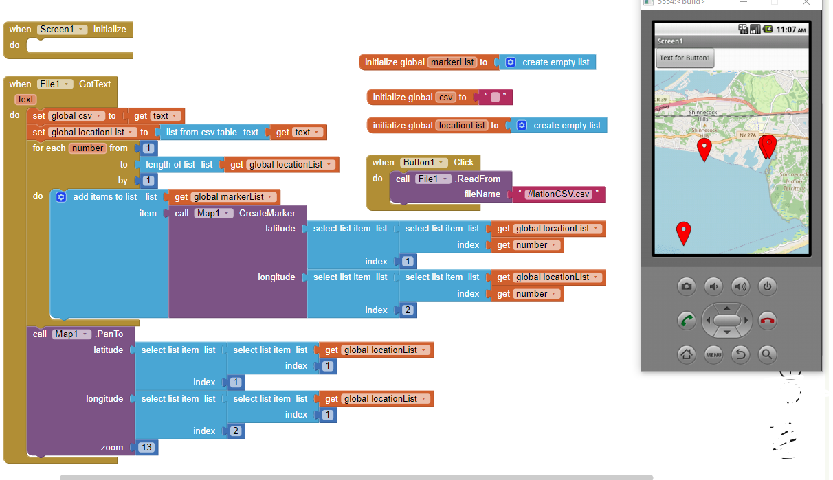
I am writing an application to read in a CSV file of latitude and longitude data. The program reads the data into two lists, one containing the latitude and one the longitude. When I call Map1.CreateMarker routine, I receive a Runtime error that the marker cannot accept the arguments. Here is a screenshot to show the code, CSV file, and error. Any advice is greatly appreciated.
Hi SteveJG,
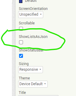
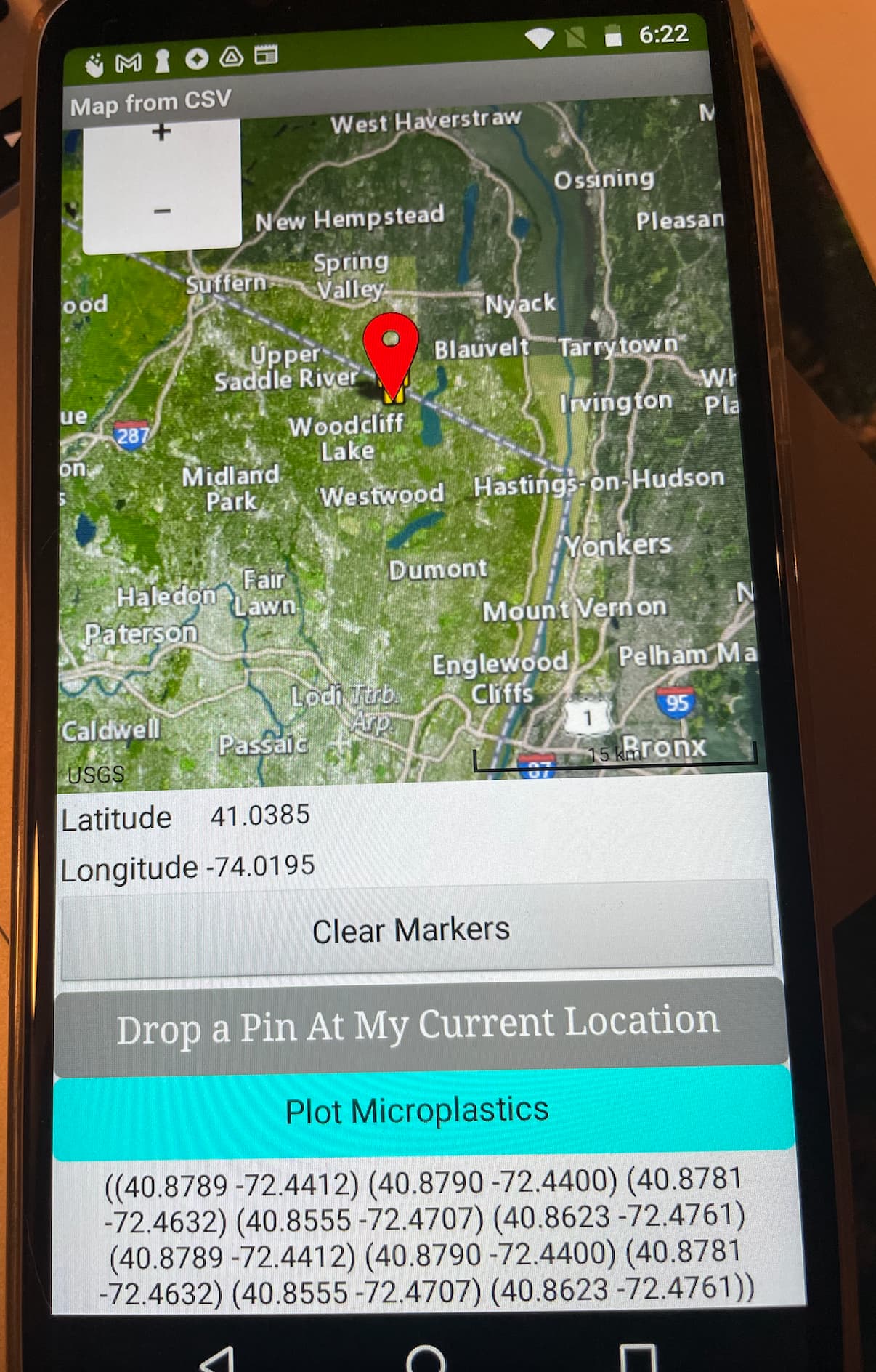
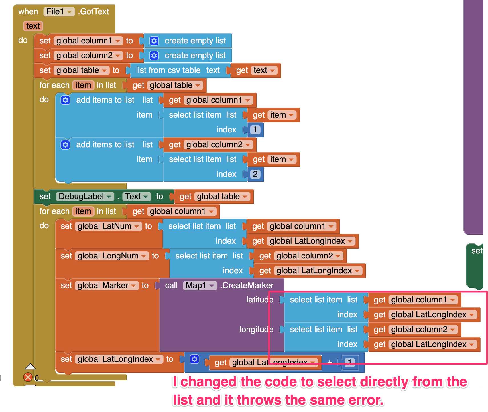
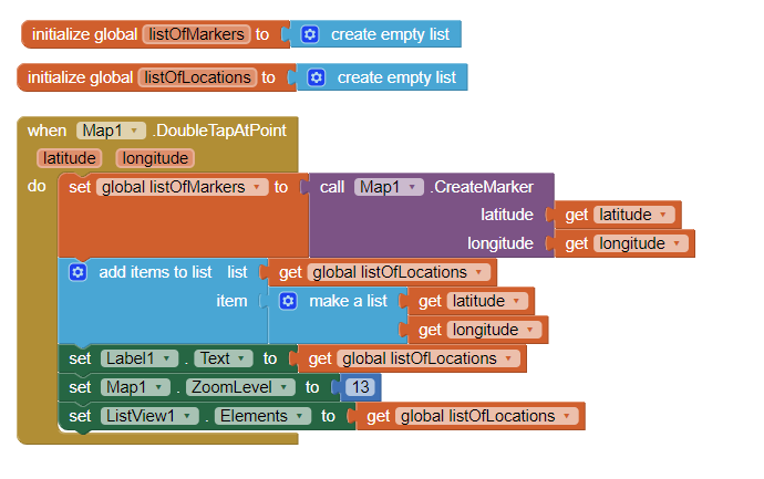
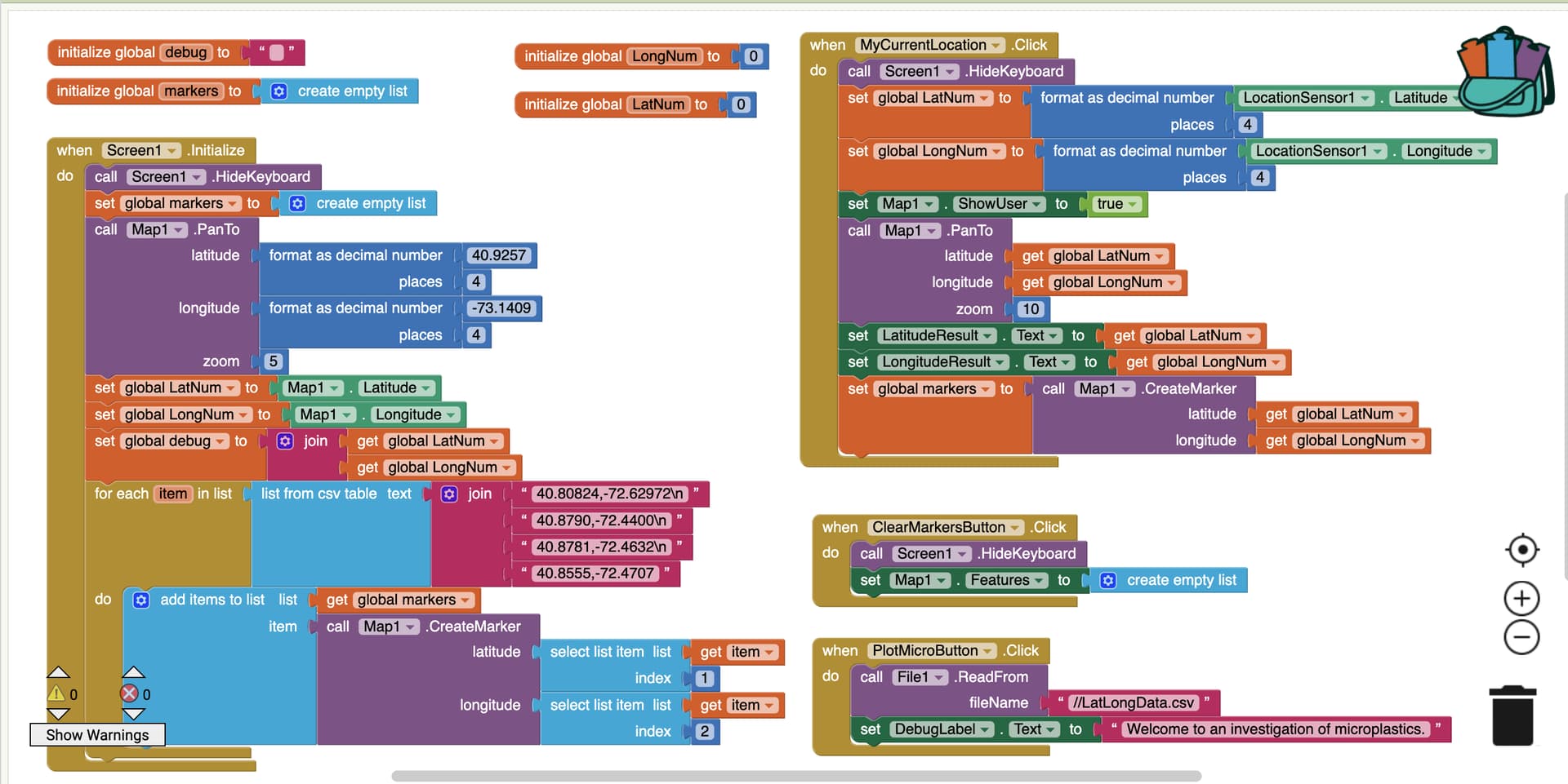
Many thanks for your reply. I tried the "uncheck" of the ShowListsAsJson and received the same error. Here is a screen annotation to explain my strategies and an image of my Android phone paired with the app. The program's purpose is to provide the user with their location on a map when the "Drop a Pin at My Location button is pressed - which works. Then, I want to drop pins for the ten lat/long pairs, I want to create a marker for each of the locations. I have a "debug" label at the bottom of the screen that shows the contents of the table of lat/long pairs.
Hi SteveJG and TimAI2,
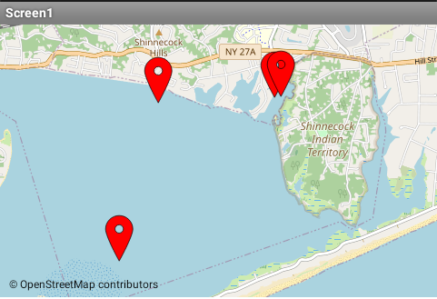
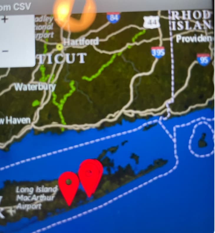
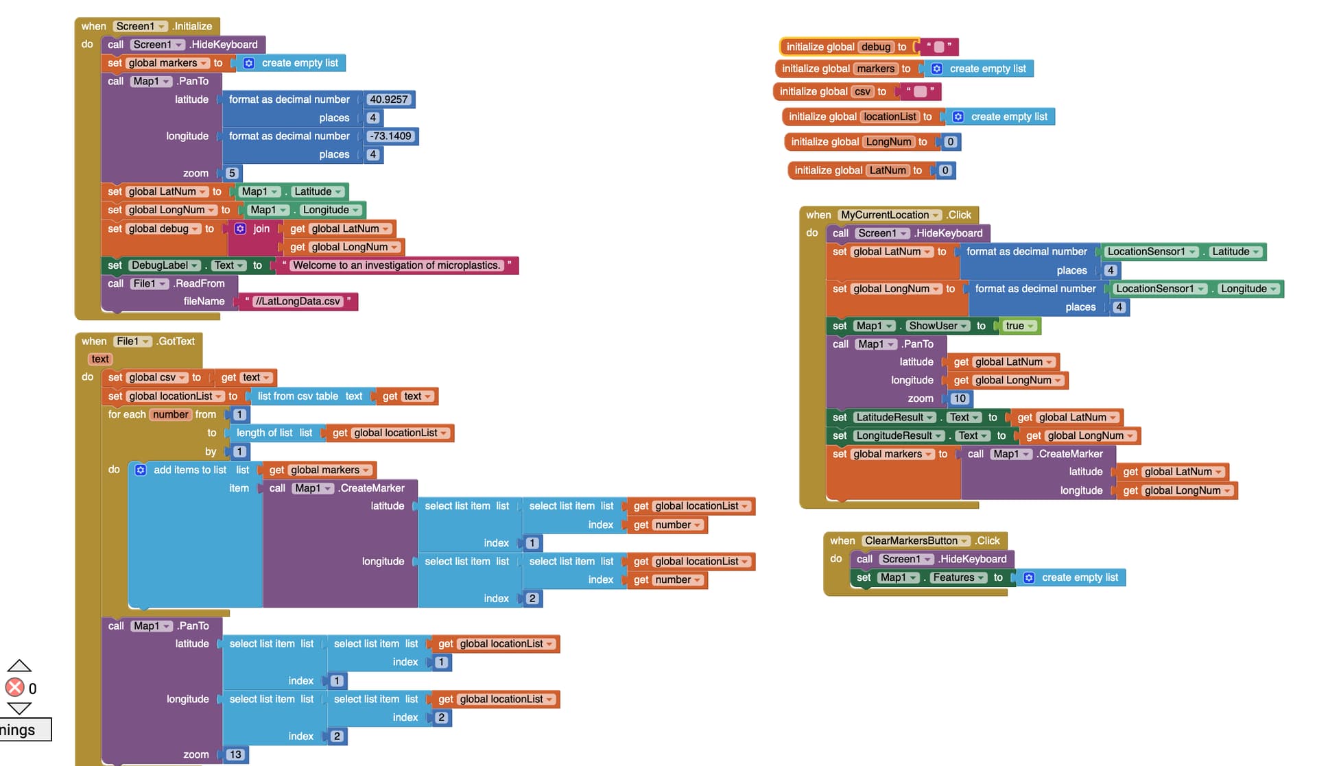
Here is the solution that worked. One of my students wants to plot the location of microplastics in the Shinnecock Bay of Long Island. I took the original longitude and latitude data and verified the locations in Google. The first location was invalid; hence, the program could not plot the location. I selected four verified locations and entered them into the join block of the CSV table. Now the location markers plot to the correct locations. I suggested that my student only plot up to four to five locations at a time since the "real estate" of the MIT App Inventor screen is too small to plot 65 data points in her original file. Thank you so much for all of your help! I will try the DoubleTapAtPoint in another version of the program.
Best Sharon
Not necessarily true. The map can show the entire extent of the samples and zoom in for detail. Your student can plot all of the locations using one file. Use the zoom and pan capabilities of the Map to view at different 'magnification' and locations.