Hola amigos, Me pueden ayudar?
ya tengo la aplicación casi terminada, he salido a la calle a probarla pero tengo un problema:
El mapa no cambia de posición mientras camino. mantiene al user en la posición inicial, necesito que se actualice solo lo mas rápido posible y que cuando entre en circule1 suene una alarma y se muestre una imagen. Esto ultimo creo que lo tengo bien programado, pero como el mapa no se mueve , no puedo probarlo.
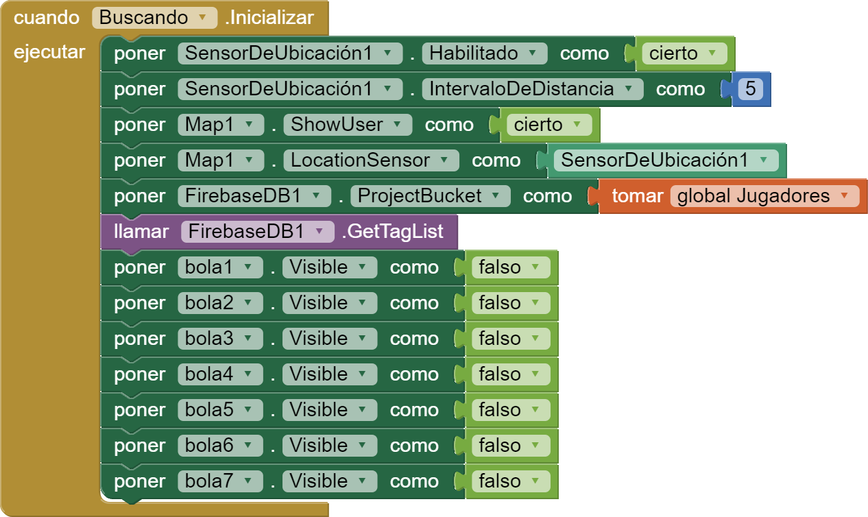
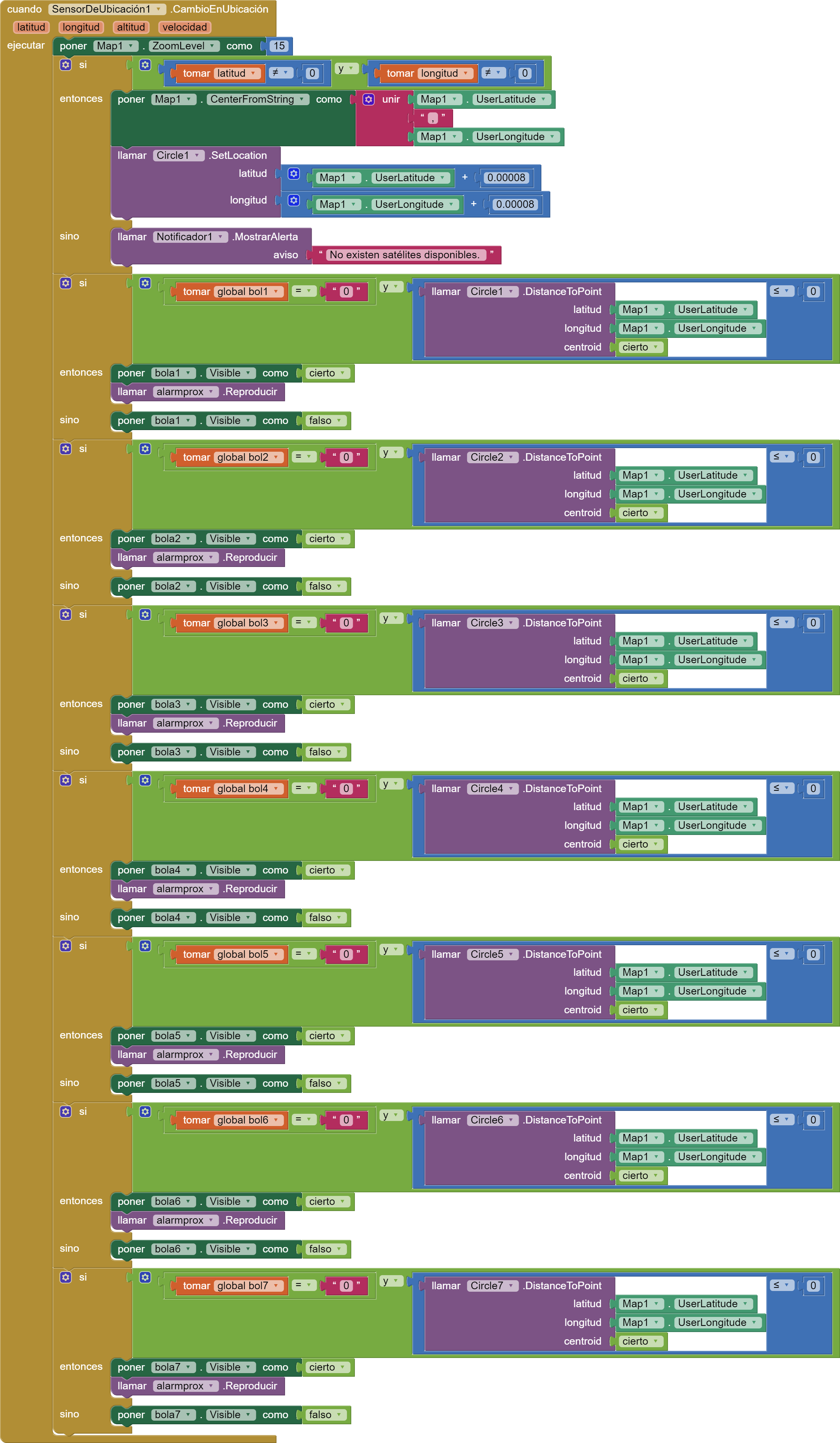
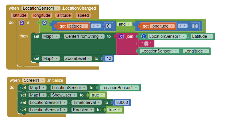
Estos son los dos bloques principales del mapa y sensor de ubicación.
No se donde está el problema, por favor ayuda.
Muchas gracias
Welcome Boret.
-
I suspect part of your issue is how you use the if..then Blocks and what value bol1 = 0 and bol2=0 etc. is supposed to do.
-
Another possible issue is you may be using an Android 10+ device that might require permission Blocks?
-
You use Firebase but you don't have any Blocks saving or using location data with it. Have you coded that part yet?
Here is a similar app that uses a CloudDB (similar to a FirebaseDB) that works Social Distancing ... a CloudDB / Location Marker Tutorial
Have you tried the tutorial? Does the Project in the tutorial work on your device?
I am unable to debug your Spanish Blocks. You might post your aia code and someone might look at it.
1 Like
El enlace al aia: albogiffactualizado3.aia - Google Drive
Si ya vi ese tutorial entre otros, y creo que lo tengo bien, pero algo falla y no se que es. necesito que cuando voy andando, el mapa se mueva manteniendo al user en el centro. y actualmente se quedan quietos el mapa y el user.
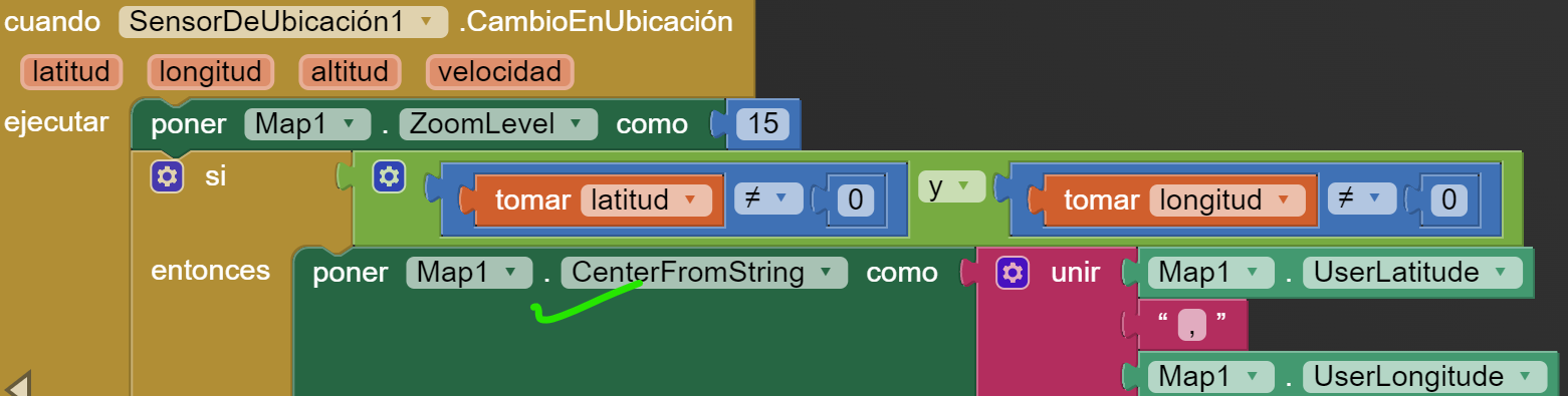
Use this Block... you already have it It just might not be in the right place.
.
Alternatively you can use this
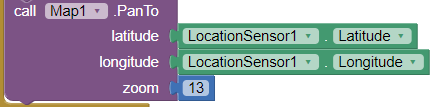
but be aware, the PanTo block sometime glitches. ![]()
Your If..then Blocks might be interfering with this method of centering your location in the Map. You can test this by making a copy of your Project and deleting the If.. Blocks and then walking and testing if your map re-centers. Be aware you already told the app to update a LocationChange if the change is 5 or meters or more. You might change 5 to 0 and see what happens. Also you did not set the timeinterval using Blocks. I recommend 20 to 30 seconds (20000 to 30000 ms).
You might post the aia directly into this box Boret. Sorry, I will not visit a GoogleDrive link although others might.
1 Like
Muchas gracias, no me deja subirlo aqui. es mas pesado de lo permitido. Anteriormente tenia un intervalo de tiempo puesto de 30000 pero me sucedia lo mismo. y lo cambie por 5 metros a ver si mejoraba, pero tampoco.
1- If you have not read and done the following tutorial, do it now and try the example aia code. Using the Location Sensor
2- Code snippet to plot and center your current location on a Map component.
The first location plot may take up to a minute for the gps receiver to realize where it is and obtain a satellite fix; subsequent satellite fixes will take about 30 seconds.
If you do not see a location change on the Map, try setting the zoom to 15 instead of 10 (so you can see small location changes) ![]()
Build the Project and test it. What happens? You should see your present location centered.
This topic was automatically closed 7 days after the last reply. New replies are no longer allowed.