Ref-
How can I draw a (dynamic) regular polygon on a map? - MIT App Inventor Help - MIT App Inventor Community
I have studied this. there is preselected co-ordinates which after button get polygon generated. but...
I want my user to draw polygon on map and then to get its co-ordinates of polygon extracted as input to next screen.
How can it be done. Please guide and suggest.
Your requirements are explored here:
read everything...
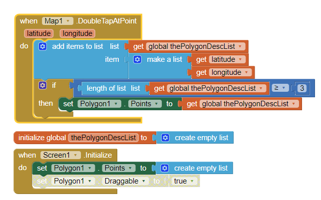
To 'draw' the polygon simply, you could use code to touch the map where you want a polygon 'corner'

Polygons begin as basic triangles. So the first three points do not display until you add additional points using the DoubleTapAtPoint
Are you moving the polygon to another Map? If so, copy the polygon points and reconstruct the polygon in another map. If you need to plot to a Canvas, you have to convert real world lat/lon coordinates to Canvas screen coordinates to plot to the Canvas.
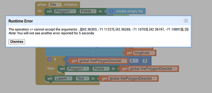
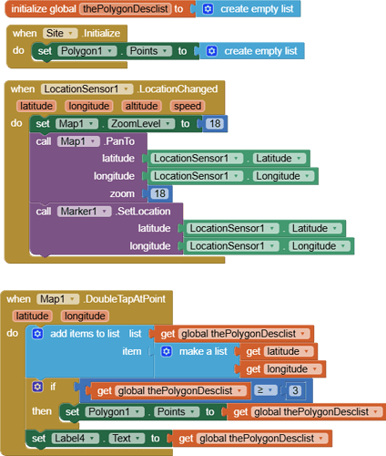
Maybe you wanted to compare the length of list to 3?
If you want to check if the list has 3 or more elements, then check the length of the list, instead of the content of the list (use length of list block)
I want my user to draw polygon on map and then to get its co-ordinates of polygon extracted as input to next screen.
As you can see in the example provided by @SteveJG
you need to compare the length of the list (to know if the list has 3 or more coordinates) in order to draw the polygon.
Oh how can i forget this? now get resolved .... thanks
This topic was automatically closed 7 days after the last reply. New replies are no longer allowed.


