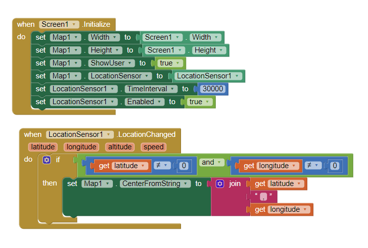
Hai ,
I made the following program but now I would like it to draw a red line of the route I'm taking and save it in a jpeg or something similar
All info is welcome
Hai ,
I made the following program but now I would like it to draw a red line of the route I'm taking and save it in a jpeg or something similar
All info is welcome
You do that by capturing your coordinates using a LineString to plot your track progress.
Here are four examples showing how to make an elaborate track.
The * FG_GPS_Cloud_LS example shows how to use the native LocationSensor (what you are doing) along with a CloudDB to plot and share a track with others.
You do not need to be that elaborate, just code to plot your previous coordinates using a LineString without the CloudDB.