hiking trail API offers only x,y routes so I need to chance it y,x. API offer not allow saving routes data. It would be best if LineFromString accepts x,y routes but I couldn't see any option. So am I missed any available extension for this? or any possible approaching for read x,y routes data?
Could you provide a link to that API?
Also a link to the doc for
http://ai2.appinventor.mit.edu/reference/components/maps.html#LineString
(I found that myself)
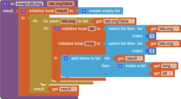
If you have the JSON text for a list of points in (long,lat) order, use the Web component's DecodeJSONWithDictionaries block to decode it as a table (list of lists), and run that table through a value procedure to swap columns 1 and 2.
Then load the LineString.Points from the swapped table.
Draggable blocks:
(I am winging this, having not used the API or maps LineString before.)
similar issue of 'reversed lat and lon) in a json file discussed here with two solutions Problem with coordinates in an JSON file - #12 by Juan_Antonio and Problem with coordinates in an JSON file - #13 by TIMAI2

