What you have in your FeatureCollectiion are the coordinates of a Polygon with multiple coordinates. A single set of coordinates is necessary to navigate for each building. Make a List of buildings and their coordinate or write very complex code to use the json for the destination coordinates to build your destination selection ListView
An example List for two buildings:
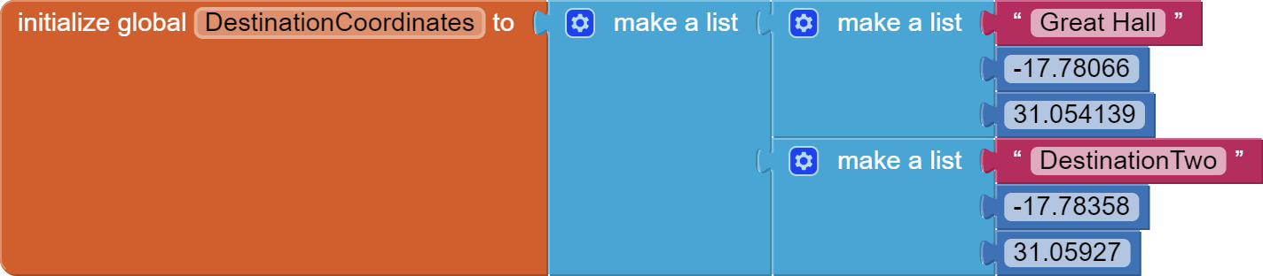
What is possible using a List of Buildings in the form Building, latitude, longitude is shown here:
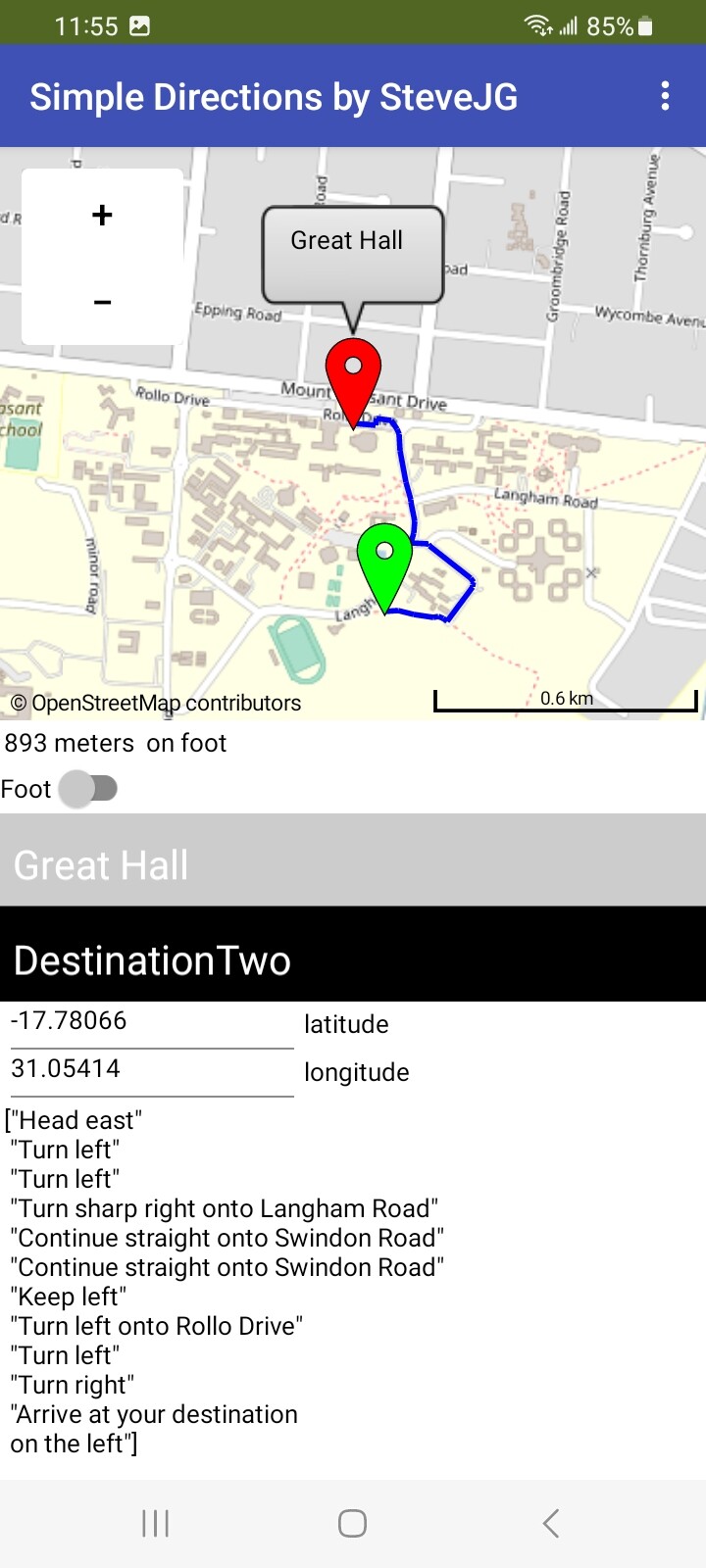
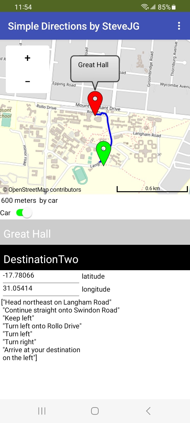
using the Navigate by foot option (left) and car option (right).
The user's location is the green marker; the destination is the red marker. I used the coordinates of the first coordinate shown for the Great Hall polygon.
The directions are pretty vague ( in my opinion). They certainly do not provide the best route using the Navigation tool and probably do not need to be displayed. Showing just the user location, destination location and track on the map might be sufficient.